Wednesday, August 31, 2011

Canadian Prairies

When my family first moved to Dallas years ago, we became friends with another family who had moved from Alberta, Canada. They have a book about the Canadian Prairies which I was really fascinated with, which is the inspiration for this post.

Major cities in the region are: Edmonton, Alberta; Calgary, Alberta; Regina, Saskatchewan; Saskatoon, Saskatchewan and Winnipeg, Manitoba. Oil and natural gas resources and abundant underground water has led the Praries and Plains region of North America to be one of the strongest economies of late. Cities like Edmonton and Calgary are booming all the way down to Oklahoma City and Dallas in America.

The Canadian Prairies are a part of the larger Great Plains, a region almost 2,000 miles north/south extending all the way south to Texas. In fact, by some definitions, it extends even into Mexico. Though many assume grasslands are void of much life, they are full of it. Earlier Europeans made this mistake when they called the region: 'The Great American Desert'.

The Great Plains are a relatively recent landscape. It wasn't until about 10,000 years ago the Canadian Prarie became mostly treeless grassland after the last glacial retreat. The area is mostly flat but can be rolling as well. It gets very cold during the winter and warm--though unlike the southern plains--usually not extremely hot.

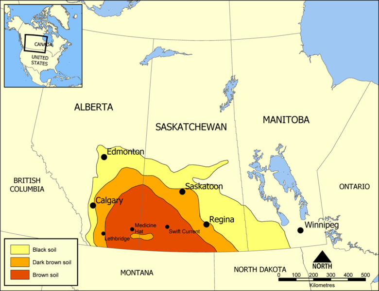
File:Palliser's Triangle map.png
Created by NormanEinstein July 18, 2005.

File:Prairie Rainbow Canola Flax.jpg
Fields of Canola and Flax on the Saskatchewan Prairie. Photo: Saffron Blaze .

File:Saskatchewan River Bridge.jpg
Saskatchewan River. Photo: Leighton Tebay, 28 September 2004(2004-09-28) Lei

File:Canada-Saskatchewan Production Studios.JPG
Canada-Saskatchewan Production Studios circa 2010. Photo: Masalai.
File:Red River cart train 2.jpg
Ox cart train on Red River Trails, Unknown date. Photo: Whitney's Gallery

File:Sifton (Manitoba).jpg
A farm in the rural municipality of Sifton. Circa 2006 Photo: Northwest


Chinook arch over the city of Calgary, Alberta, Canada . Photo: Qyd, March 2007(2007-03) User:
User

File:Farm Hwy 37 Alberta Canada 02A.jpg
An autumn afternoon at a farm north of Highway 37, west of St. Albert, Alberta, Canada. 1 November 2008. Photo: WinterE229 WinterforceMedia

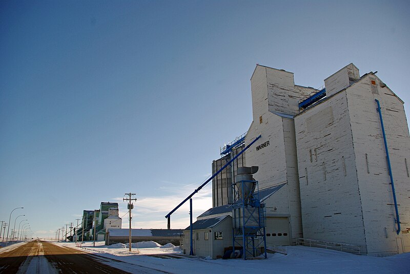
File:Warner Elevator Row.jpg
Familiar sight clear down thousands of miles to Oklahoma and Texas.

Warner elevator row berta3 January 2010 Photo: Hero122.,
File:69 Calgary.jpg
I love this photograph. Calgary circa 1969. Photo by Will Henderson of Calgary 69. 


Calgary is the largest city in the Canadian Praries. It is repeatedly listed among the most liveable cities in the world. This picture is as seen from Crescent Heights bluff during sunset. Photo: Calgarypano

File:Hawrelak-Park-Watercourse-Edmonton-Alberta-Canada-01.jpg
A watercourse in Hawrelak Park, Edmonton, Alberta. Canada. 2008.05.10. Photo: WinterforceMedia WinterE229 .

Friday, August 26, 2011

Korea

The Korean Peninsula is a magical land full of serene, poetic landscapes. Most of the landscape is low mountains with many islands off the coast. There are more than 500 endemic plant species to the peninsula. Though mountainous, the area is of low earthquake activity. The landscape has several forested regions, including both deciduous and evergreen forests. Seoul is the largest city in South Korea and has over 10 million people. It is one of the largest cities in the world. At near 3.4 million, Busan, South Korea is the second largest city. Pyongyang is the largest city in North Korea Korea. South Korea has 16 administrative regions and is home to nearly 50 million people.

Sadly, due to the large population on the relatively small peninsula, space is limited. Much of the once pristine land is being destroyed. Some of the major rivers are the Kum, the Naktong and the Han. The penninsula which has been settled for at least 10,000 years is inhabited by people decended most likely from Siberia, Mongolia, or both.

File:Korea satelliet.jpg


File:Teheran Ave night.jpg
Teheran Ave in Gangnam-gu, Seoul, South Korea. 1 July 2007(2007-07-01) Photo: Patriotmissile .

File:Korean.Seoraksan-Ulsanbawi-01.jpg
The scenery of Dobongsan (Mt.Dobong), Seoul, South Korea 8 July, 2006. Photo: flowerguy

File:Korea-Jejudo-Coast-03.jpg
Jeju-do, South Korea 7 Febuary 2008. Photo: Martin Chen

File:Gotjawal Forest on Jeju Island-01.jpg
The Gotjawal Forest, on Jeju-do Island, off South Korea.  Seen from the Peace Museum in the western part of Jeju-do. The Gotjawal Forest is very rare on the island and in South Korea, because most of the flat terrain has already been developed for agricultural or industrial purposes - in this densely populated island and country. April 25, 2009 Photo: Yongchangjang .
File:Gotjawal Forest.jpg
The Gotjawal Forest in Jeju Island, South Korea. Because Gotjawal Forest is formed on rocky areas, as this picture shows, rainwater penetrates into groundwater aquifer directly, making the Gotjawal forest the most important ecology for water resources in Jeju-do, a volcanic island. August 29, 2008 Photo: Yongchangjang .

File:Gloydius ussuriensis.JPG
A Gloydius Ussuriensis snake on the forest floor. Observed in the Gotjawal Forest, in the Dong Baek Dong San (the Camelia Forest) habitat, on Jeju Island, off South Korea. 20 December 2008(2008-12-20) Photo: Yongchangjang .

File:Changbai chute1.JPG
Waterfall, 2005 Photo: Shizhao .

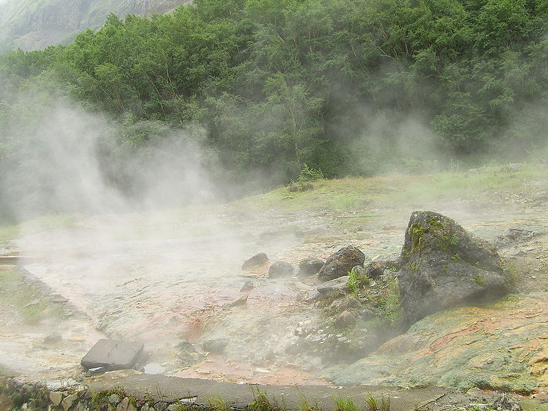
File:Changbai hotspring.JPG
Hot Springs, 2005. Photo: Shizhao

File:Changbai Shan 2008-06-14 IMG 1469.JPG
Changbai Shan 14 June 2008. Photo: Mätes II

File:Gwaneum Peak at Songnisan.jpg
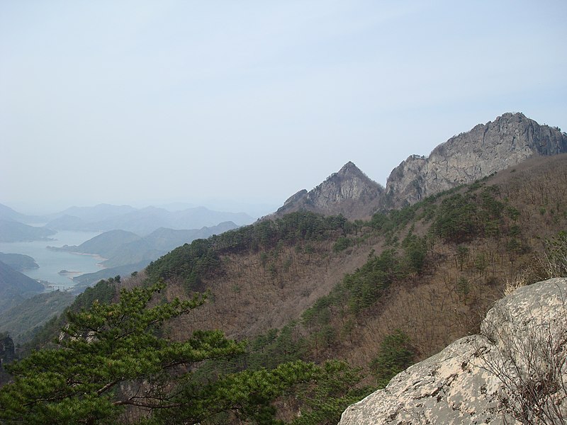
Gwaneum Peak at Songnisan in South Korea. The photograph was taken from Munjandae. 22 April 2007(2007-04-22) Photo: Yoo Chung .

File:Mount Worak Korea 242.jpg
Mount Worak Korea April 2008  Photo: Rhythm

File:Seoraksan1.jpg
Seoraksan, 23 October 2004. Photo: Seaniz .

File:Deogyusan from Hyangjeok Peak.jpg
Photograph of Deogyusan in the South Jeolla province of South Korea, taken from Hyangjeok Peak. Photo: Yoo Chung , 30 December 2006(2006-12-30). Photo...
File:Juwangsan national park canyon.jpg
Phoasofjodjf

File:Snow in Sobaeksan national park.jpg
Sobaeksan National Park. 'Snowed flower of sobaeksan' 5 January 2003(2003-01-05), Photo and Description: Joone Hur.

File:Juwangsan national park canyon.jpg
Canyon in Juwangsan National Park. September 1, 2010. Photo: garycycles3 .

File:Halasan.jpg
Crater lakes on the vulcano Hallasan , Jeju-do island.

File:Waterfall on Jeju Island, Korea.jpg
Waterfall on Jeju Island, Korea, 24 February 2006(2006-02-24). Phorto Photo: Douglas Knisely

File:Korea-Gangwondo-Odaesan National Park 1663-07.JPG
Odaesan National Park, located in the province of Gangwon South Korea was designated as a national park in 1975, is named after the 1,563-meter Odae mountain. The name "Odaesan" means "mountain of five plateaus", which refers to the five plateaus found between its five peaks. 20 November 2010. Photo: Steve46814 .

File:Korea-Hongdo Island-01.jpg
Hongdo Island in the Dadohae National Park area located in Sinan-gu, Jeollanam-do, South Korea. 2 May 2008. Photo: justinjfj .

File:Changbai-2005.JPG
Cairns on Baekdu Mountain 2005 (border between North Korea and China).
中文: 许多人来到长白山,在天池附近将石头堆成高高的一堆,以表示自己的祝愿 Photo: Shizhao

File:SV100365.JPG
长白山天池的水从长白瀑布落下后,向山下流去。
Baekdu Mountain 2005. Photo: Shizhao .

File:Baitou Mountain Tianchi.jpg
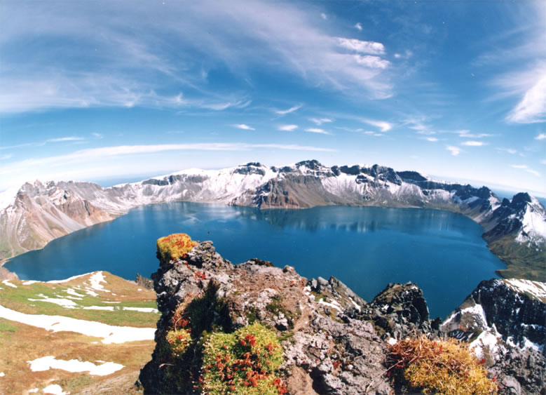
A crater lake at Tianchi (Heaven Lake, 天池) at Baitou (Chinese Changbai Shan) at the border of China and North Korea. 17 June 2005. Photo: Bdpmax .

File:Korea-Mountain-Jirisan-15.jpg
The scenery of Jirisan, in South Korea, 2006. Photo: eimoberg .


Thursday, August 25, 2011

City Profile 016: Hong Kong

CITY PROFILE 016: HONG KONG
Coordinates: 22°16′42″N 114°09′32″E
Elevation: Near sea level
Daily Mean Temp: 23.1 Celsius (73.6 Fahrenheit)
Metro Population: 7 million.
Estimated 2050 Metro Population: 9.6
Risks: Overpopulation, pollution, poor air quality, hot humid weather.
Advantages: Wealthy. Future prosperity is in Asia.
Resources: Immediate: Port Regional: Fish.
Other: Hong Kong stands as an example for what free markets can achieve. While China maintains strict command economy over most her people (which is supposed to help everyone) the standard of living in Hong Kong is embarrassingly higher than the neighbor to the North.


File:Hong Kong Skyline Restitch - Dec 2007.jpg
In using this image or any subsequent derivatives of it, you are required to release the image under the same license. As such, any reproduction of this image, in any medium, must appear with a copy of, or full URL of the license.
Attribution of this image to the author (DAVID ILIFF) is required, preferably in a prominent location near the image.
No other conditions may be added to, or removed from this license without the permission of the author and copyright holder.

Wednesday, August 24, 2011

Sonoran Desert

There are some special places on earth that people have connected with on a deeper level than other places. Israel, Greece, Japan, The British Islands, India, Peru, all have rich cultural and mystical aspects, with landscapes which inspire and have set the scene for history--more so than other places. Another place like this is the Sonoran Desert of North America.

North America has several Desertes. The largest is the Great Basin. The Chihahuan desert is the second largest, the Mojave the smallest. The Sonoran, is probably the most famous. The Sonoran desert is also home to the most famous and iconic desert plant in the world--the saguaro cactus. And believe it or not, this cactus, is native to only this desert. No where else on earth naturally has saguaro cactus.

The Sonoran desert is a land of rich diversity. Along with the iconic saguaro cactus, few plants are as iconic as the creosote bush (Larrea tridentata). Ocotillo, cholla, prickly pear, mesquite and palo verde are also important plants. When I was in Palm Srings, Coachella area a year or two ago, which is in the Mojave desert, I saw tons of 'jumping cholla'. Though I am sure footed, I was a victim of this cactus. I really liked them though--even if they do seem to jump out and stick you. Surprisingly there are 30 native species of fish in the Sonoran desert. In geologic time, the Sonoran desert is recent (see my post on Geography Changes for how geography isn't constant-in fact far from it).

This desert has fewer natural disasters than many other areas. Flash floods, lightning storms and days of extreme heat are a few of the risks. One interesting phenomenon, which have been in the news lately are the somewhat rare Haboobs. The Phoenix Haboobs of 2011 were a reminder of strange weather phenomenons not commonly known. The Phoenix Haboob of 2011 was national headlines and several more have already happened this year.

Now that the summer is going to begin slowly lifting its terror off of the southwest, I can actually bear to highlight this region.


File:P2230002.JPG
Scene in Saguaro National Park.

File:Organ pipe cactus 11.jpg
Organ Pipe Cactus National Monument, Arizona, USA.

File:Organ pipe cactus arches.jpg

Two arches in organ pipe cactus national monument. Taken Christmas Day 2000 by Pretzelpaws with a Casio QV-3000EX camera, 2004-10-27 Photo:  Pretzelpaws.
File:Hohokam Pima National Monument.jpg
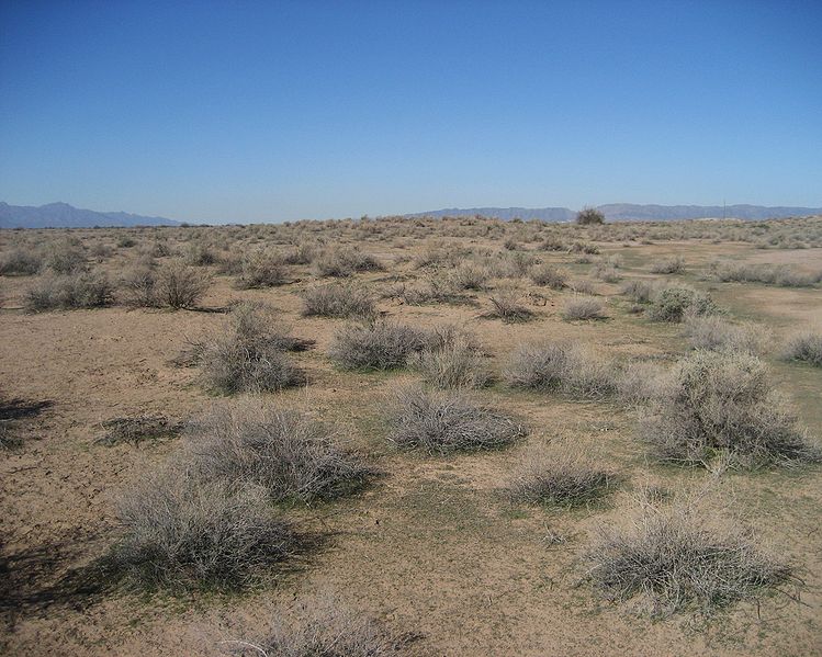
Hohokam Pima National Monument, Arizona, Jan 17, 2008. Photo: BruceandLetty .
File:Saguaro National Park1935.jpg
I love old photographs!
Saguaro National Park, East Unit, Southern Arizona - ca. 1935, USGS
File:Sonoran Desert 33.081359 n112.431507.JPG
"This is an image of the Sonoran Desert approx. 30 miles west of Maricopa, AZ. (Near 33.081359, -112.431507)" Caption and photo by: Highqueue. January 2007(2007-01)..

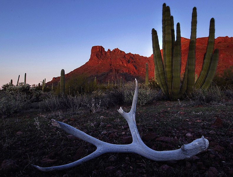
File:Organ Pipe & antler.jpg
Organ Pipe & antler, OPNM, 21 July 2007. Photo: PDTillman.

File:Sonoradesert 1.JPG
Taken at the Arizona-Sonora Desert Museum. December 2006 Photo: Santryl
File:Sonoradesert 1.JPGFile:Sonoradesert 1.JPGFile:Sonoradesert 1.JPGFile:Sonoradesert 1.JPGFile:Sonoradesert 1.JPGFile:Playa Santispac - Bahía Concepción - 180 pano.jpgFile:Playa Santispac - Bahía Concepción - 180 pano.jpg
File:Playa Santispac - Bahía Concepción - 180 pano.jpg
180° Panorama on Playa Santispac of Bahía Concepción, Baja California Sur. Several islands are visible in the bay: (left to right) Isla San Ramon, Isla Blanca, and Isla Coyote. On the right is Playa Concepcion with its associated developments visible. Photo by Gregg M. Erickson. 17 December 2009(2009-12-17)"...

File:Infiernillo Tiburon Island.JPG
View of Tiburon Island across Infiernillo channel. Stephen Marlett, 2007.

File:Cabo San Lucas street 1.jpg
Photo of street in Cabo San Lucas, Mexico, taken November 2005 by Stan Shebs

File:Baja California Desert.jpg
Baja California Desert in the Cataviña region, south of Ensenada, Mexico. Saguaro cactus. May 2003.
File:Valle de Sonora.jpg
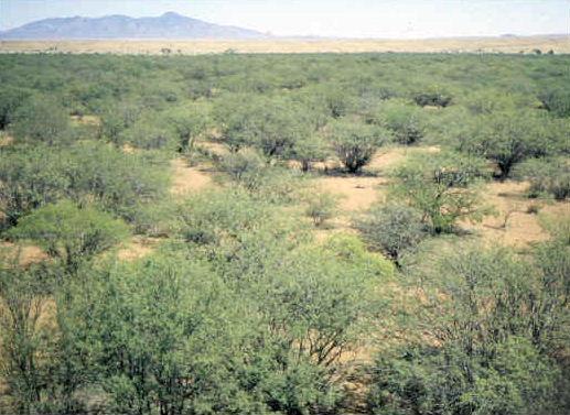
 Chaparrales de Sonora, México 2004.

File:Jbda-trail-az-1.jpg
Cottonwood tree along Santa Cruz River on Juan Bautista de Anza National Historic Trail. Photo by Matthew A. Lynn.
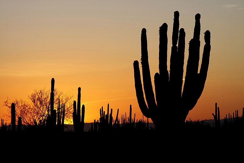
File:Sonoran desert sunset.jpg
Sunset in the Sonoran Desert, Mexico. Atardecer en el Desierto de Sonora, Mexico. Tomas Castelazo.

File:Puerto peñasco zona hotelera.jpg
Hotels in Puerto Peñasco Gabrieel13

File:Cerro de Trincheras.jpg
Photos from Cerro de Trincheras in Sonora, Mexico 10 January 2010(2010-01-10), Photo: Matt Peeples.

File:Saguaro Sunset.jpg

The silhouette of a large saguaro stands at sunset in Saguaro National Park on the east side of Tucson, Arizona, 2010. Photo: Saguaro Pictures.

File:Sunset and cactus.JPG
Scottsdale, Arizona.

File:Scottsdale cityscape4.jpg
Taken atop an unnamed hill in Scottsdale, Arizona.

File:Glendale Glitter & Glow.jpg
Glendale, AZ during the Glendale Glitters 2004. Taken by user Evette.File:Scottsdale waterfront.jpg
View of the Scottsdale Waterfront on a clear December day. Photo taken from the new pedestrian bridge connecting the Marshall Way shops with the Fifth Avenue arts district. 31 December 2008, Joseph Plotz.
File:Saguaro National Park Panorama.jpg
Saguaro National Park, Arizona, USA. Photo by Hugh Mason.
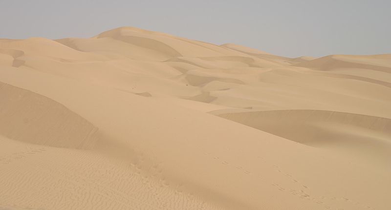
File:Imperial sand dunes.jpg
Imperial Sand Dunes, Glamis, CA. Taken 8/8/03 by Pretzelpaws with a Canon 10D camera and cropped using the Gimp. 26 January 2005. Photo: Pretzelpaws.
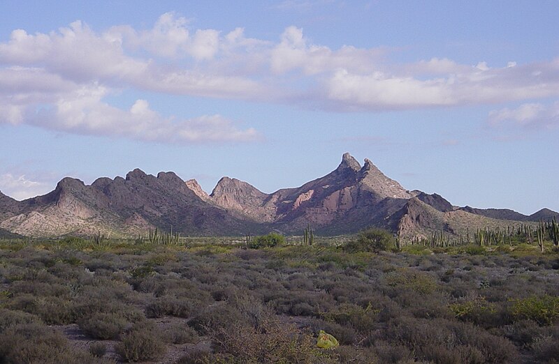

File:Hasteecöla.JPG
Hastéecöla peaks near Kino Bay, Stevemarlett. 2007.
*Beautiful Picture!