If you have ever looked for the text of poem spray painted on one of the walls (near the Oklahoma City National Memorial 'Survivor Tree') at the Oklahoma City Bombing Memorial here it is:
*I did my best to keep the original capitalisation's and punctuation
"
Team 5
4-19-1995
We Search For the truth
we seek Justice.
The Courts require it.
The Victims Cry for it.
And GOD demands it!
"
I have seen the poem in person twice (in October 2009 and October 2010). As a poet, it was my favorite part of the memorial by far.

A blog about geography, travel, anthropology, archaeology, history and more.
Tuesday, May 31, 2011


Friday, May 27, 2011
Ancient Indonesia
One of the great centers of civilisation that is almost never discussed is Ancient Indonesia. Ask anyone, even an archaeologist or historian and unless they specialize in the region they will probably have very little information about the complex history of this part of the world where as they would know a lot more about others.
Indonesia had its first major colonization around 3000 BC. From then on, it has been a population center. Even now, Indonesia is the fourth largest country population wise in the world.
Indonesia is similar to other great islands like Ireland or Great Britain in that it has been ruled by many different invading cultures. This means you see vast differences in culture across the different parts of the country. For example, Bali is a majority Hindu island, while Indonesia as a whole, is majority Moslim. Christian and Buddhist traditions also have followers due to different conquests.
For the most part, Java has been the centre of power for Indonesia through out history. Besides Indonesias strategic location between Arabs and Indians and the Far East, Indonesia was coveted for it's wealth in gold and spices. Nutmeg, in particular was the draw. Now, coffee and tea are prized crops of the region, with Sumatran coffee being amongst the highest rated in the world.
Indonesia had its first major colonization around 3000 BC. From then on, it has been a population center. Even now, Indonesia is the fourth largest country population wise in the world.
Indonesia is similar to other great islands like Ireland or Great Britain in that it has been ruled by many different invading cultures. This means you see vast differences in culture across the different parts of the country. For example, Bali is a majority Hindu island, while Indonesia as a whole, is majority Moslim. Christian and Buddhist traditions also have followers due to different conquests.
For the most part, Java has been the centre of power for Indonesia through out history. Besides Indonesias strategic location between Arabs and Indians and the Far East, Indonesia was coveted for it's wealth in gold and spices. Nutmeg, in particular was the draw. Now, coffee and tea are prized crops of the region, with Sumatran coffee being amongst the highest rated in the world.
Thursday, May 26, 2011
City Profile 007: Beijing, China
CITY PROFILE 007: BEIJING, CHINA
Coordinates: 39°54′50″N 116°23′30″E
Elevation: 43.5 m (143 ft)
Daily Mean Temp: 54.6 Fahrenheit, 12.55 Celsius
Metro Population: 19,612,368
Estimated 2050 Metro Population: ?
Risks: Overpopulation, political center and therefor prone to conflict, water issues, pollution, poor air quality, censorship, dust storms.
Advantages: Capital of an emerging superpower, capital of a country with a history of civilization going back thousands of years, capital of one of the most aggressively expanding economies in the world, city of opprotunity in the future.
Resources: Immediate: Regional: Agriculture land, limestone, sand, gold, molybdenum, iron ore, marble, diopside, coal.
Other: Most likely will be one of, if not the most powerful cities on earth in 50-150 years.

Beijing Business District 2007. Photo: CobbleCC
Coordinates: 39°54′50″N 116°23′30″E
Elevation: 43.5 m (143 ft)
Daily Mean Temp: 54.6 Fahrenheit, 12.55 Celsius
Metro Population: 19,612,368
Estimated 2050 Metro Population: ?
Risks: Overpopulation, political center and therefor prone to conflict, water issues, pollution, poor air quality, censorship, dust storms.
Advantages: Capital of an emerging superpower, capital of a country with a history of civilization going back thousands of years, capital of one of the most aggressively expanding economies in the world, city of opprotunity in the future.
Resources: Immediate: Regional: Agriculture land, limestone, sand, gold, molybdenum, iron ore, marble, diopside, coal.
Other: Most likely will be one of, if not the most powerful cities on earth in 50-150 years.

Beijing Business District 2007. Photo: CobbleCC
Wednesday, May 25, 2011
The Babylonians
Much confusion surrounds many peoples understanding of Mesopotamian history in general. One area where this is most pronounced is the history of the Babylonians.
The two most famous periods of Babylonian history are more than 1000 years apart. One of these periods, is the time around the reign of Hammurabi about 1750 BC. The other period is that of the neo-Babylonian empire around 600 BC. This is the period which the Bible talks about in the Old Testament in the books of Daniel, Ezekiel and others. Though these two periods are the most famous, there were many other periods in Babylons history. However, after the neo-Babylonian empire fell to Persia, many empires controlled Babylon and it was never a major power again.
The Babylonians are best known for their knowledge of mathematics, astronomy and there city planning and architecture. The Babylonians mapped the path of various stars in the night sky, understood exponential growth of numbers, basic algebra, knew the Pythagorean theorem (before the Greeks), understood basic geometry and kept records of astronomical events.
The Babylonians practiced polytheism and based their beliefs largely on the Sumerians and Akkadians with Marduk held in especially high regard.
Babylon is located in modern day Iraq. Its' future is extremely unsure. What is sure, is that Babylons memory will forever impact civilization on earth.

Map created by: MapMaster
The two most famous periods of Babylonian history are more than 1000 years apart. One of these periods, is the time around the reign of Hammurabi about 1750 BC. The other period is that of the neo-Babylonian empire around 600 BC. This is the period which the Bible talks about in the Old Testament in the books of Daniel, Ezekiel and others. Though these two periods are the most famous, there were many other periods in Babylons history. However, after the neo-Babylonian empire fell to Persia, many empires controlled Babylon and it was never a major power again.
The Babylonians are best known for their knowledge of mathematics, astronomy and there city planning and architecture. The Babylonians mapped the path of various stars in the night sky, understood exponential growth of numbers, basic algebra, knew the Pythagorean theorem (before the Greeks), understood basic geometry and kept records of astronomical events.
The Babylonians practiced polytheism and based their beliefs largely on the Sumerians and Akkadians with Marduk held in especially high regard.
Babylon is located in modern day Iraq. Its' future is extremely unsure. What is sure, is that Babylons memory will forever impact civilization on earth.
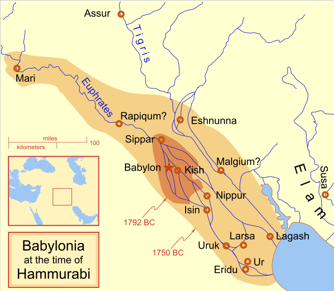
Map created by: MapMaster
Tuesday, May 24, 2011
Isle of Man
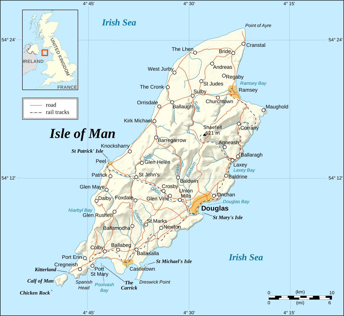
The Isle of Man is between the islands of Ireland and Great Britian. Though it isn't something you hear or read much about, it has a rich culture, a beautiful geography and contains a population of about 80,000. The island has been inhabited since before 6500 BC and has seen both Celtic and Viking settlers. The Isle of Man is home to one of the worlds unique tongues, the Manx language. Manx is a Verb Subject Object language and while no longer thriving, there are enough speakers to carry on the language for now.
The weather on the Isle of Man is wonderful. It features cool summers, mild winters and is without threat of any major natural disasters. (how many places in the United States or Australia can say that?) Snaefell is the highest peak on the island (at 620 metres; 2,034 ft) and is part of one of two mountainous areas of the island. A valley including the capital, Douglas, lies between these two mountainous sections. One of the interesting features is the Calf of Man, a small islet to it's south, with its ow history and geography.


"Manx Heritage Trail, The Braaid is the site of an ancient Celtic-Norse era community. Remnants of a roundhouse in the foreground, c. 650 A.D. and remnants of two longhouses in the background, c. 950 A.D. can be seen here situated on the rolling hills of Marown in central Isle of Man." - Description and Photo: Gregory J Kingsley

Calf of Man seen from Cregneash

Cregneash Folk Museum, Isle of Man, with Harry Kelly's cottage (right) and Woodturner's workshop (left). Photo: RuthAS

Peel Castle at Peel, Isle of Man. Photo: Finn Bjorklid

Photograph of windmill tower, South Barrule, Isle of Man, 2006. Photo: Andy Stephenson.

View from the top of Snaefell Mountain looking southwestward showing the mountainous terrain along the axis of the Isle of Man 2009. Photo: Gregory J Kingsley.

Snaefell mountain at isle of man. Photo: Finn Bjorklid.

St Runius Church (parish of Marown), Isle Of Man. Taken by Bolebridge.

Stack at cliffs near Port Erin, Isle of Man 2005. Photo: Eirik Newth from Oslo.

Picture of Bradda Head, with Milner's Tower. Port Erin is just to the right, 7th June 2005. Photo: ericbobson.

Groudle Glen Waterwheel, 2000. Photo: Trevor Rickard.
The weather on the Isle of Man is wonderful. It features cool summers, mild winters and is without threat of any major natural disasters. (how many places in the United States or Australia can say that?) Snaefell is the highest peak on the island (at 620 metres; 2,034 ft) and is part of one of two mountainous areas of the island. A valley including the capital, Douglas, lies between these two mountainous sections. One of the interesting features is the Calf of Man, a small islet to it's south, with its ow history and geography.
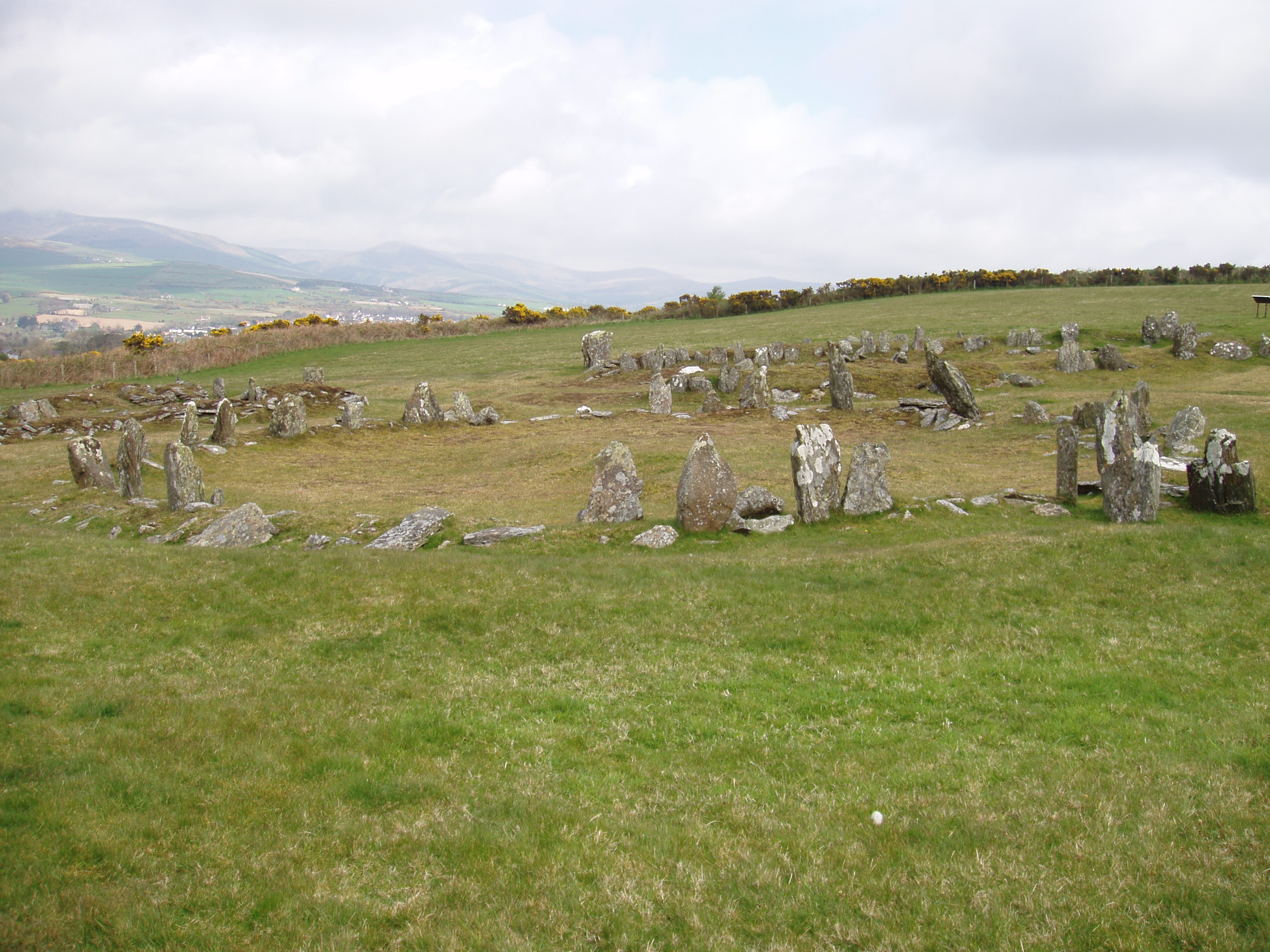
"Manx Heritage Trail, The Braaid is the site of an ancient Celtic-Norse era community. Remnants of a roundhouse in the foreground, c. 650 A.D. and remnants of two longhouses in the background, c. 950 A.D. can be seen here situated on the rolling hills of Marown in central Isle of Man." - Description and Photo: Gregory J Kingsley

Calf of Man seen from Cregneash
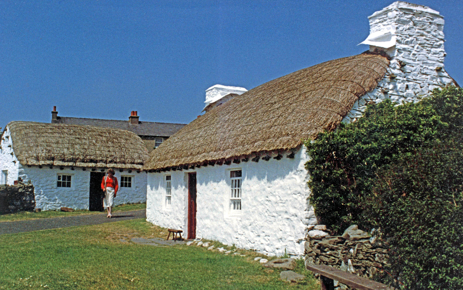
Cregneash Folk Museum, Isle of Man, with Harry Kelly's cottage (right) and Woodturner's workshop (left). Photo: RuthAS
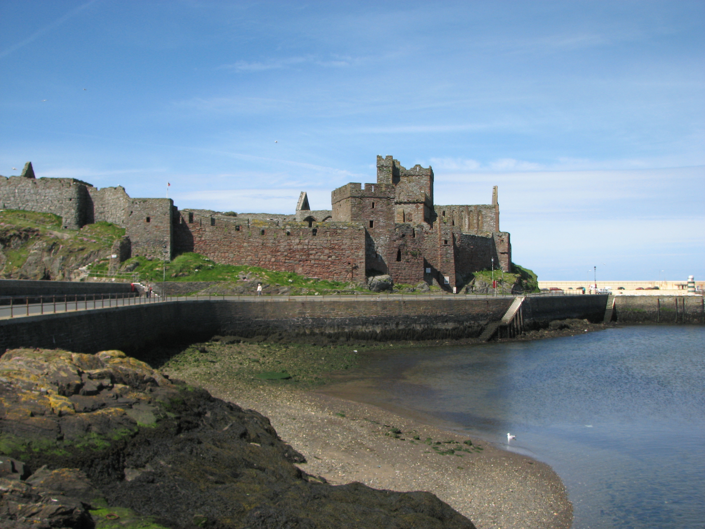
Peel Castle at Peel, Isle of Man. Photo: Finn Bjorklid

Photograph of windmill tower, South Barrule, Isle of Man, 2006. Photo: Andy Stephenson.

View from the top of Snaefell Mountain looking southwestward showing the mountainous terrain along the axis of the Isle of Man 2009. Photo: Gregory J Kingsley.

Snaefell mountain at isle of man. Photo: Finn Bjorklid.
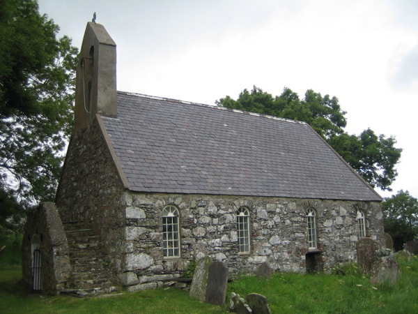
St Runius Church (parish of Marown), Isle Of Man. Taken by Bolebridge.
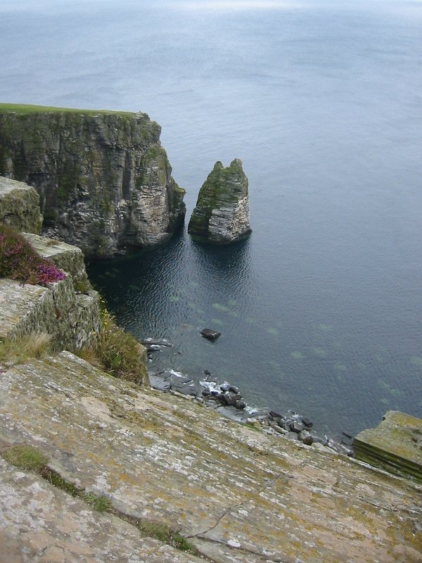
Stack at cliffs near Port Erin, Isle of Man 2005. Photo: Eirik Newth from Oslo.
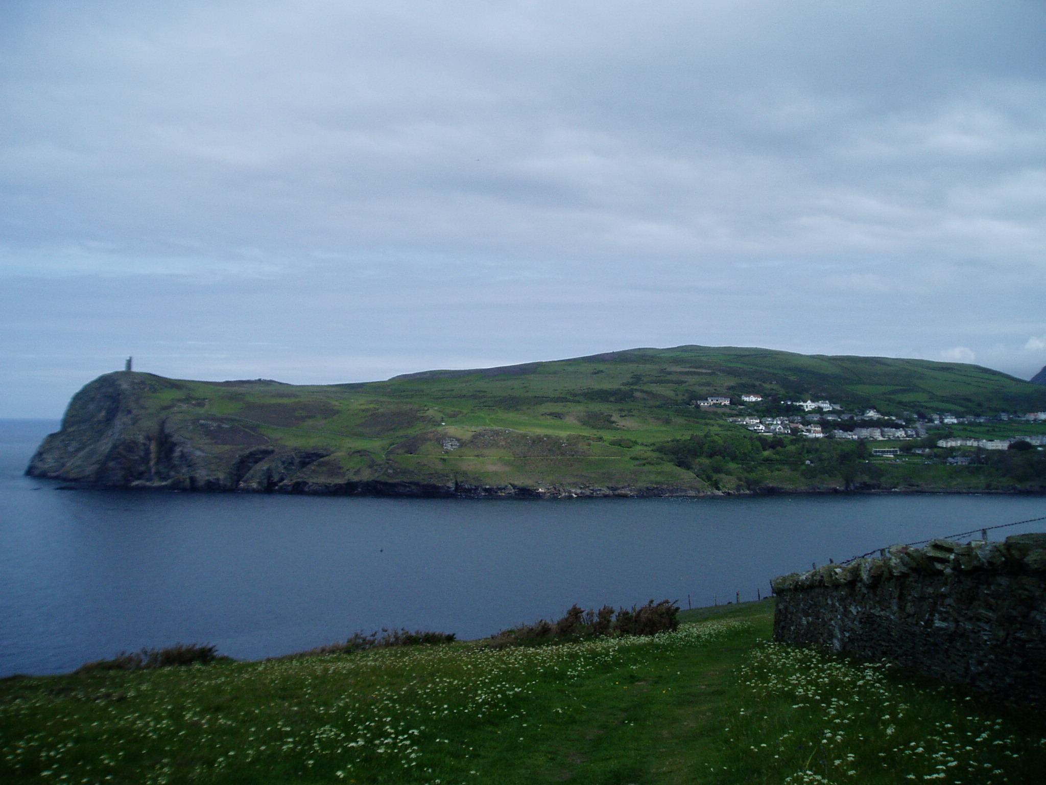
Picture of Bradda Head, with Milner's Tower. Port Erin is just to the right, 7th June 2005. Photo: ericbobson.

Groudle Glen Waterwheel, 2000. Photo: Trevor Rickard.
Friday, May 20, 2011
Madagascar
I will just let the pictures of one of the most fantastic and bizarre do the talking for todays column.


Countryside in the highlands of Madagascar Photo: Jean-Louis Vandevivère

View on the Betsiboka river and Bombetoka bay. Photo: Oledoe

Antananarivo, Madagascar 2007. Photo: Bernard Gagnon

Village in Central Highlands, south of Antananarivo in Madagascar 2007. Photo: Bernard Gagnon.

Majahilo River at Miandrivazo, Madagascar 2007. Photo: Bernard Gagnon.

Adansonia grandidieri, baobab from Madagascar, picture taken near Morondava 2007. Photo: Bernard Gagnon.

The "canyon of rats" and the "canyon of monkeys" in Isalo National Park, Madagascar.

Allée des Baobabs near Morondava, Madagascar 2010. Photo: Frank Vassen.

Rainforest, East of Madagascar, near Manakara 2007. Photo: Mauro Didier.

Spiny forest at Ifaty, Madagascar, featuring various adansonia (baobao) species, alluaudia procera (Madagascar ocotillo) and other vegetations 2007. Photo: Jialiang Gao.

Antananarivo
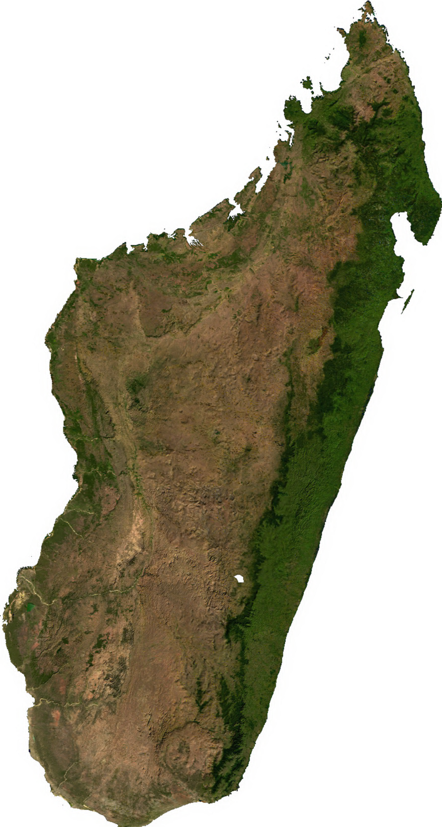
Countryside in the highlands of Madagascar Photo: Jean-Louis Vandevivère
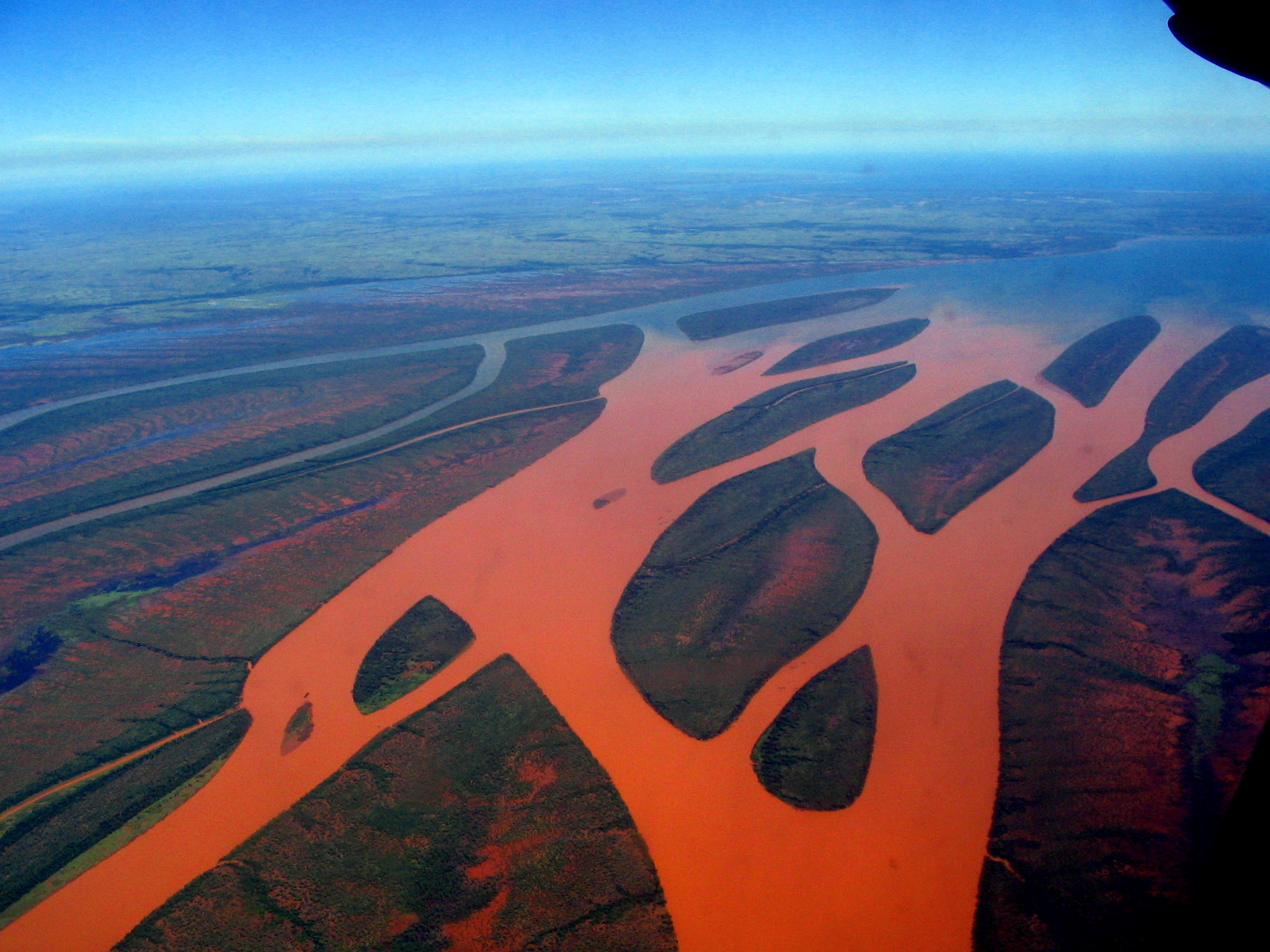
View on the Betsiboka river and Bombetoka bay. Photo: Oledoe
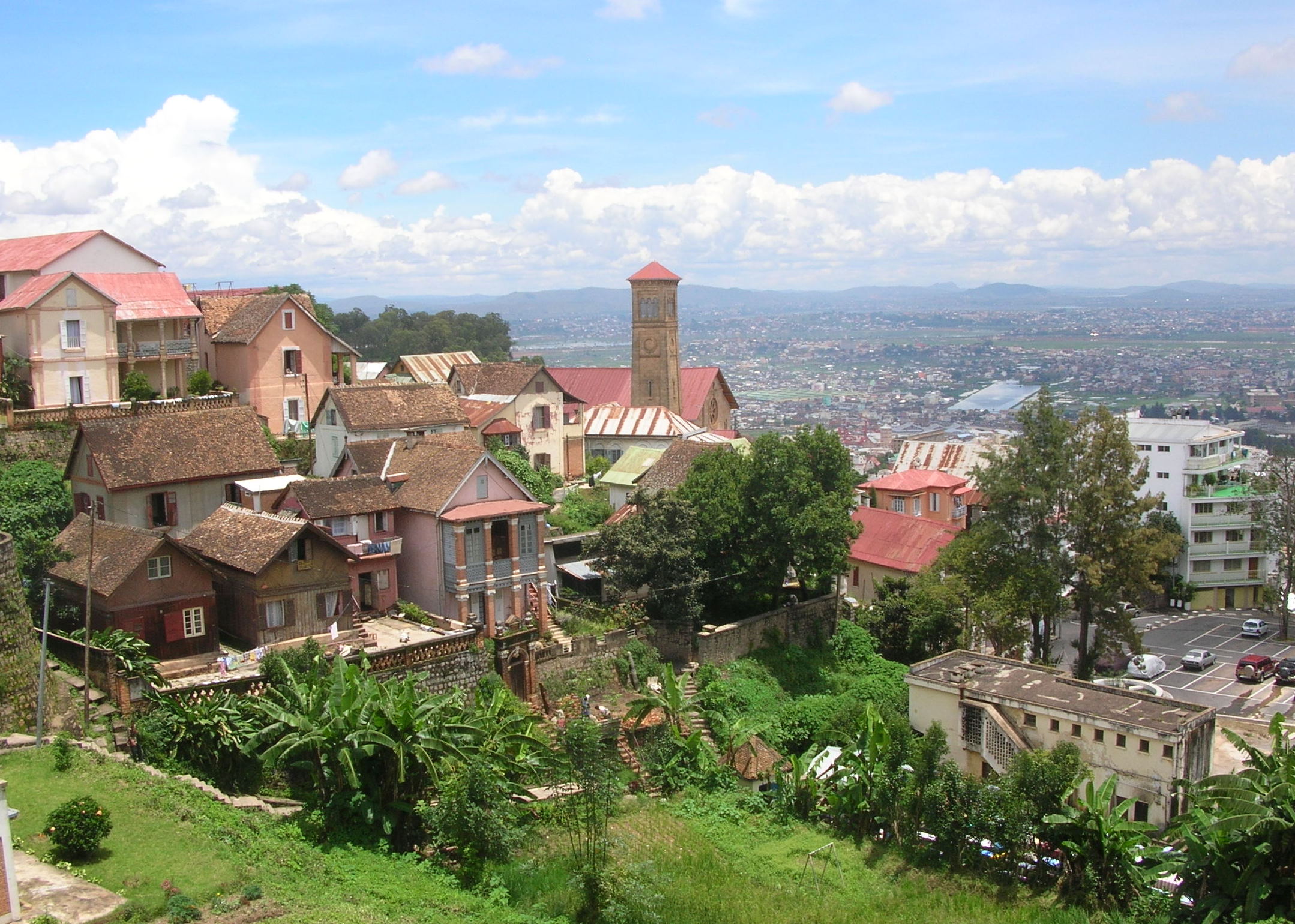
Antananarivo, Madagascar 2007. Photo: Bernard Gagnon
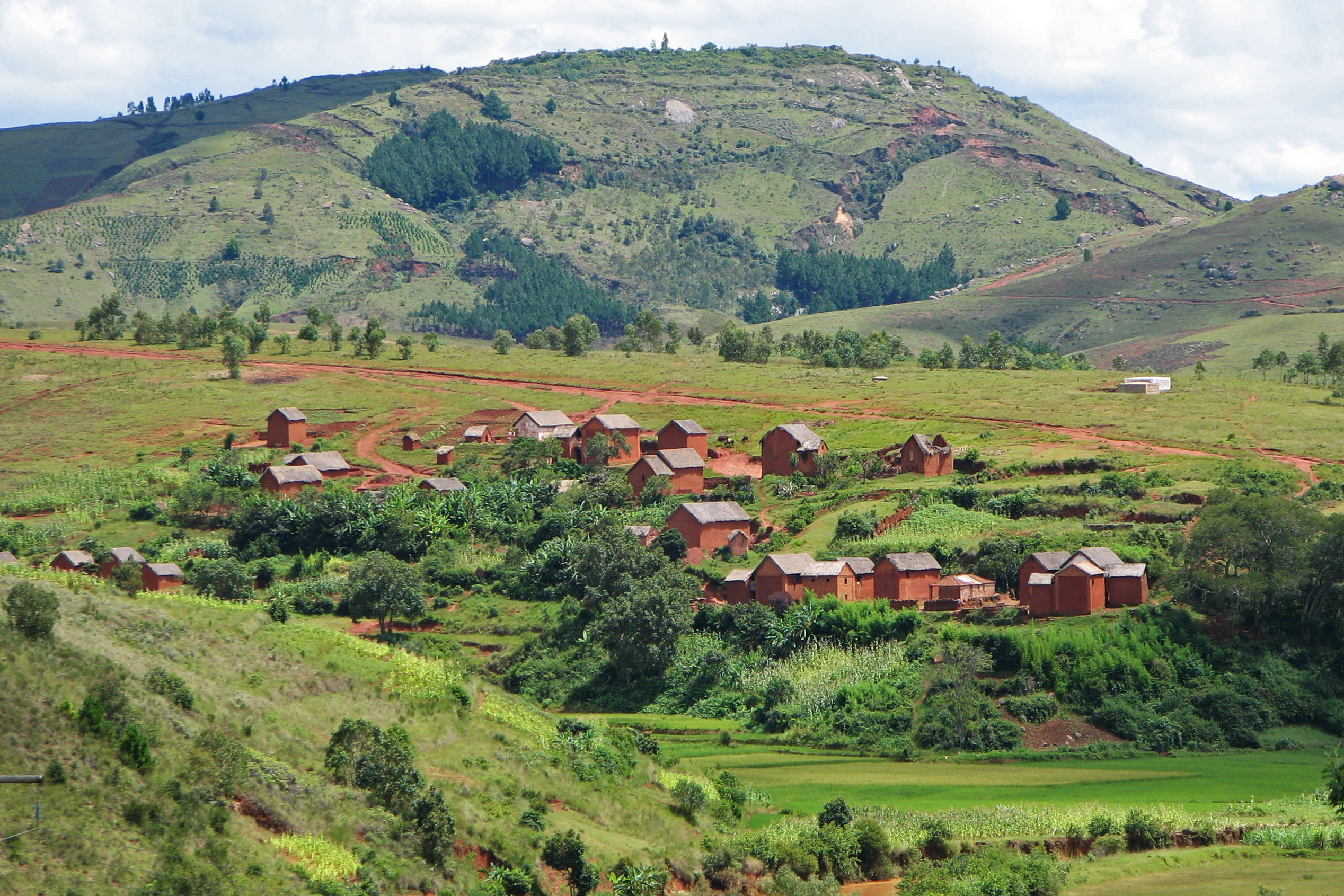
Village in Central Highlands, south of Antananarivo in Madagascar 2007. Photo: Bernard Gagnon.
Majahilo River at Miandrivazo, Madagascar 2007. Photo: Bernard Gagnon.
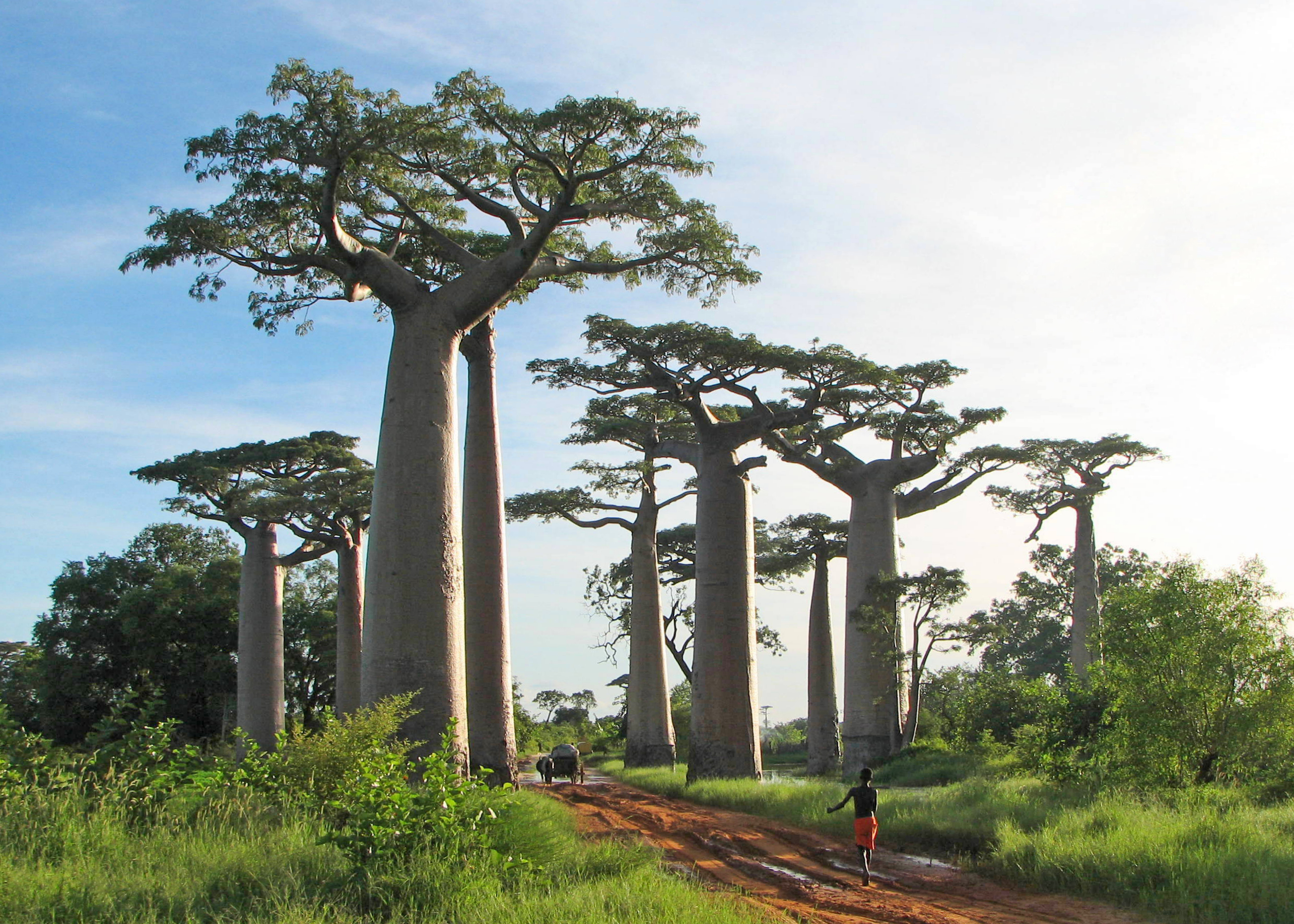
Adansonia grandidieri, baobab from Madagascar, picture taken near Morondava 2007. Photo: Bernard Gagnon.
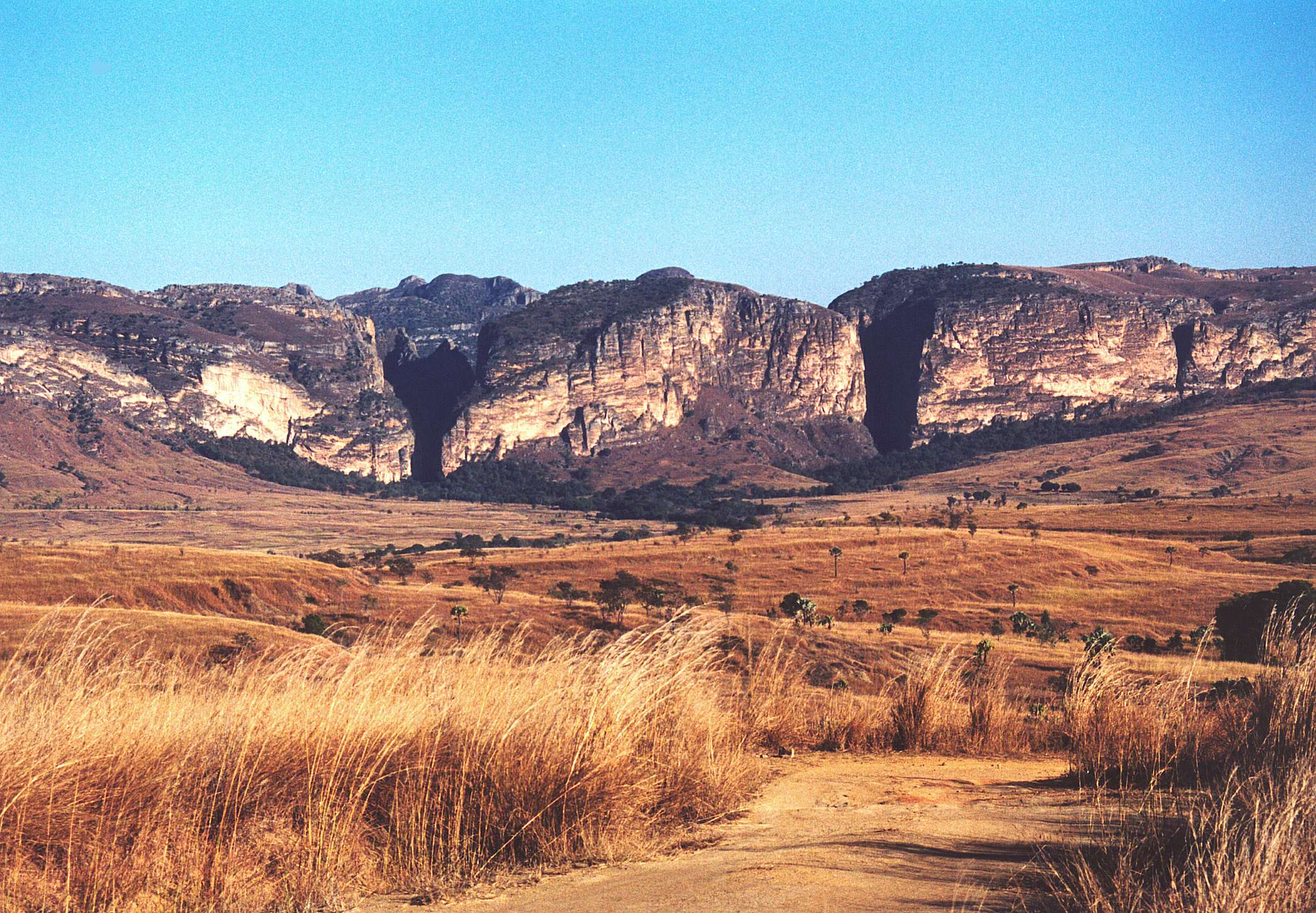
The "canyon of rats" and the "canyon of monkeys" in Isalo National Park, Madagascar.

Allée des Baobabs near Morondava, Madagascar 2010. Photo: Frank Vassen.
Rainforest, East of Madagascar, near Manakara 2007. Photo: Mauro Didier.
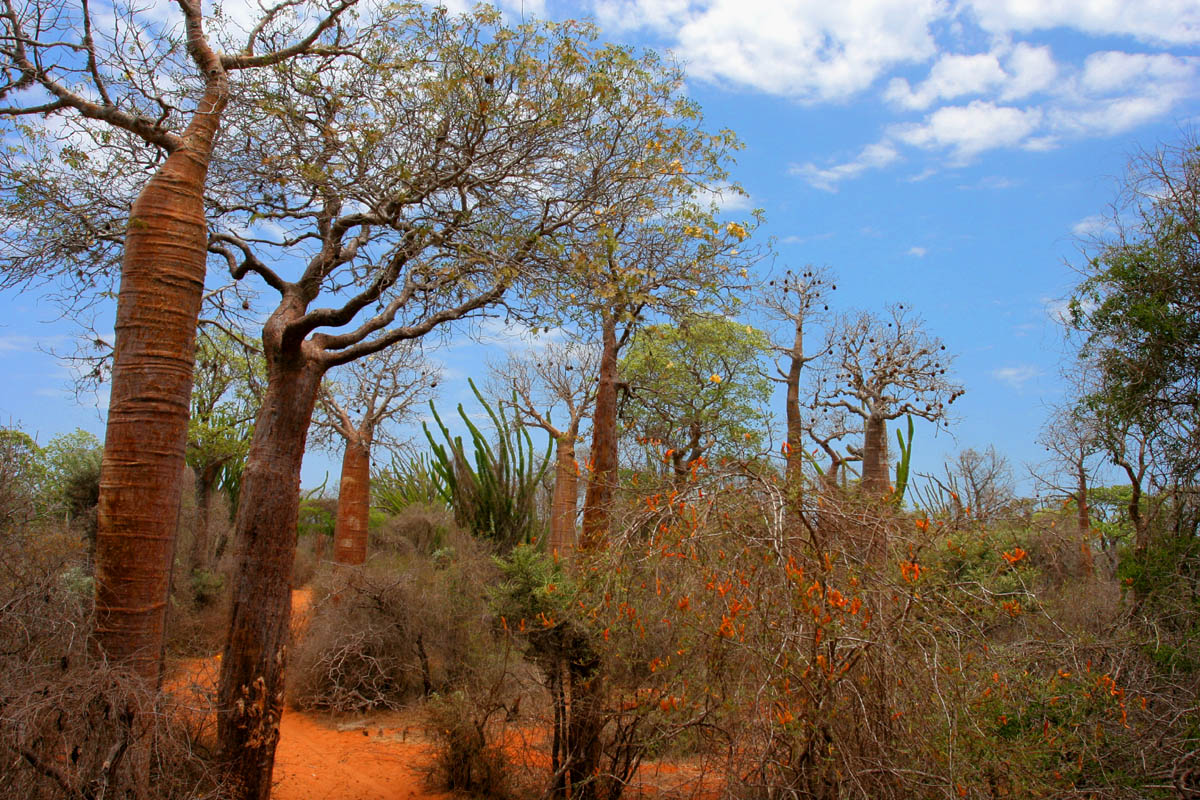
Spiny forest at Ifaty, Madagascar, featuring various adansonia (baobao) species, alluaudia procera (Madagascar ocotillo) and other vegetations 2007. Photo: Jialiang Gao.

Antananarivo
Thursday, May 19, 2011
City Profile 006: Minneapolis, Minnesota
CITY PROFILE 006: MINNEAPOLIS, MINNESOTA
Coordinates: 44°59′N 93°16′W
Elevation: 830 ft (264 m)
Daily Mean Temp: 45.3 Fahrenheit, 7.388 Celsius
Metro Population: 3,269,814
Estimated 2050 Metro Population: ?
Risks: Extreme cold (lowest average temp. of any major United States city), occasional extreme heat.
Advantages: Named top tech city in 2005, 2nd smart city to live in in 2006, one of the top cities for young professionals, liveable city, clean city, good economy, low unemployement (relative to the rest of the country) scenery within a short drive.
Resources: Immediate: abundant water Regional: water, farmland, Iron ore, taconite, coal, titaniumoxied
Other: 16th largest city in the United States in 1940, 48th currently (16th metro population). Strong Scandinavian culture.

Coordinates: 44°59′N 93°16′W
Elevation: 830 ft (264 m)
Daily Mean Temp: 45.3 Fahrenheit, 7.388 Celsius
Metro Population: 3,269,814
Estimated 2050 Metro Population: ?
Risks: Extreme cold (lowest average temp. of any major United States city), occasional extreme heat.
Advantages: Named top tech city in 2005, 2nd smart city to live in in 2006, one of the top cities for young professionals, liveable city, clean city, good economy, low unemployement (relative to the rest of the country) scenery within a short drive.
Resources: Immediate: abundant water Regional: water, farmland, Iron ore, taconite, coal, titaniumoxied
Other: 16th largest city in the United States in 1940, 48th currently (16th metro population). Strong Scandinavian culture.
Subscribe to:
Posts (Atom)