Sunday, November 13, 2011

Israel Map And Iran Map

Obviously, Israel and Iran have been in the news lately. It would be prudent for all Americans to familiarize themselves with the two countries. Therefore, I am posting three maps tonight: an Israel map, an Iran map and a map of the wider region demonstrating where they are relative to each other.


File:Is-wb-gs-gh v3.png
Map of Israel (This is a detailed map and hard to see at some sizes. Use the zoom function on your browser and it becomes very clear)


Map of Iran


Relative to each other.

Wednesday, November 9, 2011

Alaska Map

Due to today's storm in Nome, Alaska there is a lot of people who want to see a map of Alaska.


Alaska Map, (Nome, Alaska is on  the west coast on the Seward Peninsula).

Here is another one since maps are cool. And important.

Printable Map of Canada (1 With and 1 Without Province Borders)

Here are two Maps of Canada. One is blank, without province borders and one is blank other than province borders,

Canada Map

Blank Map of Canada

Canada Map

Blank Province map of Canada

Tuesday, November 8, 2011

Nome, Alaska


Nome, Alaska, aerial view, 2006. Photo: ra64

I have always found an eerie beauty to the vast wastes of the north. Places like Nome, Alaska literly lie at the end of the world. Isolated from where everyone else lives, these places are mysterious and lonely.  

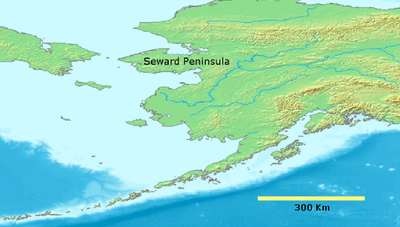
Nome lies on the west central coast of Alaska on the Seward Peninsula. The peninsula is dominated by  Black spruce, Picea mariana. Inupiats lived in the region first until 1898 when three scandanavian-americans found gold in Anvil Creek Alaska.


File:Nome 1900.jpg
Nome, 1900, library of congress photo.

In 1900 the population of Nome was a respectable, especially for the time, 12,488. It is believed the population reached 20,000 at one point (though this was never officially confirmed) as ships from San Francisco and Seattle brought thousands of fortune seekers to Nome. In fact, Nome was largest city in Alaska Territory at this point. By 1920 that number had plummeted like the cold Arctic night air to 852 souls. 

File:Nome Alaska road sign.jpg
Road sign, 2 miles north of Nome, Alaska, 16 October, 2005. Photo: ra64


Fierce storms have occured in 1900, 1913, 1945 and 1974. Today, I was inspired to write this article because Nome is in the news because of another such storm (Nome Storm of November 2011). It could end up being biggest storms in Nome in a long time.

Currently about 3,548 people live in Nome. The city has not declined in population since at least 1990.

Alaska has always had an incredible history. I remembering hearing a lecture on the 'end of the frontier' or the 'Frontier Thesis' of Frederick Jackson Tuner. While Jackons' arguement might not have meant the literal frontier and was more political and sociological in nature, I must say Alaska is still that frontier that America once was. It is still wild and grand and vast. It is also currently in the spotlight. Shows like Deadliest Catch with colourful captians like Sig Hansen and the late Phil Harris capture the imagination of a new generation (I was about 16 when I first watched the show). And then there is the story of Richard Proenneke which I discovered on PBS in the mid-2000's and so many others.


File:Tarns in Kigluaik Mts., Seward Peninsula.jpg
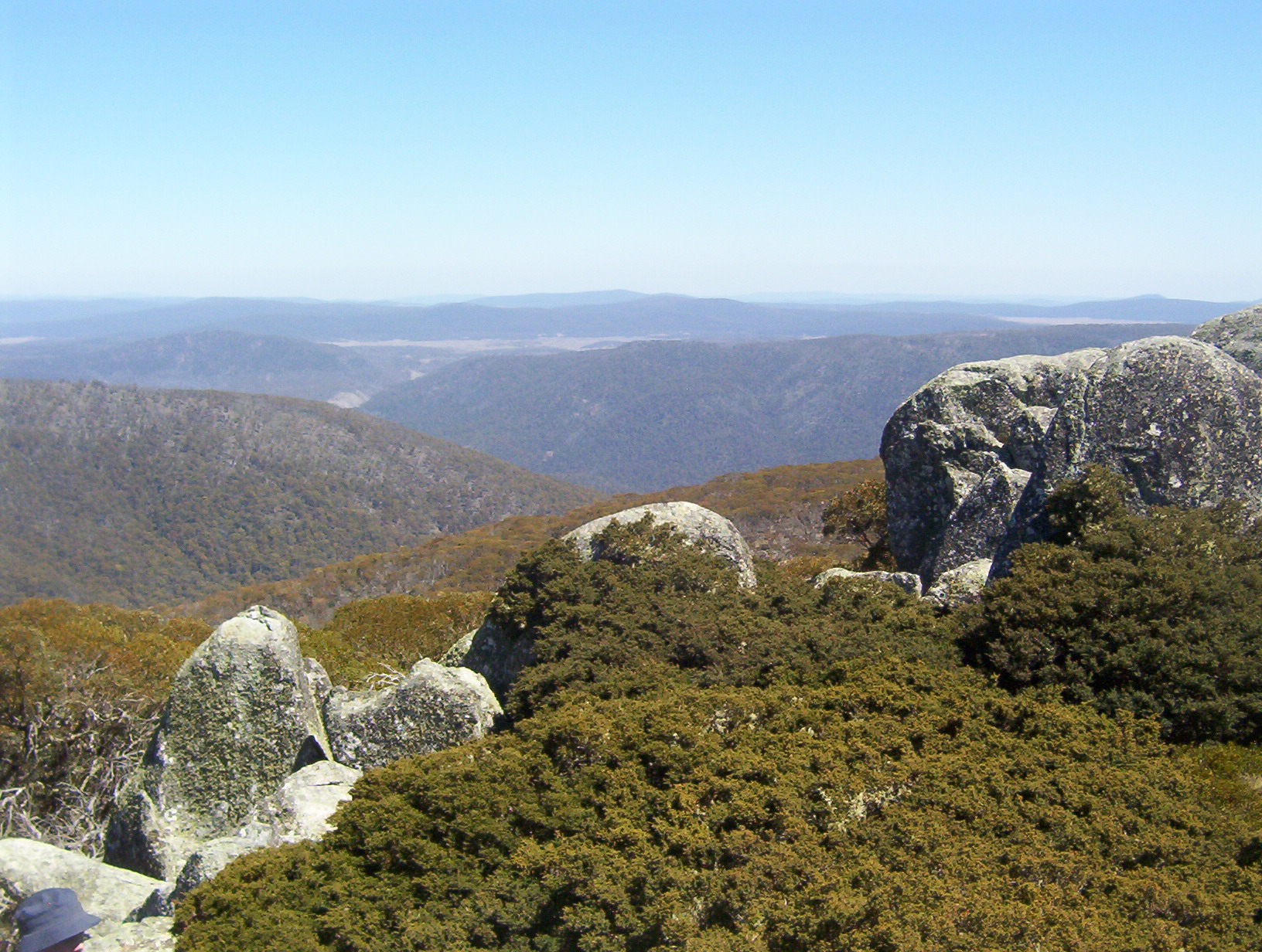
tarns in Kigluaik Mts., Seward Peninsula, 12 December 2009.


 File:Seward peninsula.png
Demi Public Domain Map Server

Thursday, November 3, 2011

Photography of Todd Tobey

Truly spectacular photography of Oklahoma by Todd Tobey on this site:

http://www.flickr.com/photos/tobey308/

I am not going to put any pictures up since I haven't asked permission but I highly recommend you check out his flickr, you will not regret.

Wednesday, November 2, 2011

Australian Alps

File:AustAlpsRegionMap.png

The Alps in Europe are very well known. The Southern Alps, located in New Zealand are less famous. But few outside of Australia have probably heard of the Australian Alps. They form part of the Great Dividing Range, the third longest land based mountain chain in the world.

File:Mt Buller village Stevage.jpg
Isn't Austria nice! Actually, this is Australia. 9 July 2007. A view over the central part of the Mt Buller village. Photo: Steve Bennett


File:Perisher Olympic Ski Trail.JPG
J.Lee, Digital Photograph of Perisher - showing Mount Perisher's Olympic Ski Trail, covered in winter snow complete with skiers.


File:Perisher Blue - Kosciuszko.jpg
On the slopes at Mount Blue Cow, Perisher Blue Resort. 28 July 2006 Photo: Ruth Ellison.

File:Mount Ginini - Namadgi National Park - 2.jpg
Mount Ginini - Namadgi National Park 2006-10-04 Photo: Dfrg.msc


Pictographs!
Yankee Hat Aboriginal Artwork in Namadgi National Park, Australian Capital Territory. Taken by me (Martyman) November 2005.

File:Mount Ginini - Namadgi National Park.jpg
Mount Ginini - Namadgi National Park 2006-10-04. Photo:  Dfrg.msc .

File:Lake-Mountain-trail.jpg
An (ungroomed) trail at Lake Mountain after recent snowfall. Taken by me Shogun 10:50, 17 February 2006 (UTC).

Panoramic view across the Mt Buffalo plateau. The highest peak on Mt Buffalo, The Horn at 1,723 m, is the white peak to image right approximately 3 km from the location of the camera (a walker's safety fence can be seen on top). The large number of dead trees visible resulted from the 2006-07 Victorian Alps Bushfires. Mount Buffalo National Park, Victoria, Australia. Taken by John O'Neill.

File:Mt buffalo plateau.jpg
View of the Mt Buffalo plateau as seen from below the Horn. Photo: Zoltan Olah

File:Everlastings on MtHotham Vic.jpg
Looking over everlastings on Mt Hotham to Mt Feathertop, Victoria, Australia. 12 Mar, 2005. Photo: John O'Neill


File:MarysSlide.jpg
View of Mt Hotham ski fields after 20 cm fresh snowfall, featuring the notable ski run "Mary's Slide". June 2006, Photo: Chris Solnordal.

File:Mt Buffalo The Horn.jpg
Mt Buffalo The Horn, 2 December 2006 Photo: Percita Dittmar

Tuesday, November 1, 2011

What Is The Longest River In Asia?

The Yangtze (in China) is the longest river in Asia and the third longest in the world. It is 3,915 miles/6,301 km long. The Huang He or Yellow River, also in China, is the second longest in Asia and the 6th longest in the world at 3,395 miles/5,464 km long. The Mekong is the third longest in Asia, the Lena (in Russia) is the fourth and the Irtysh River, also in Russia is the 5th longest in Asia.