Thursday, July 14, 2011

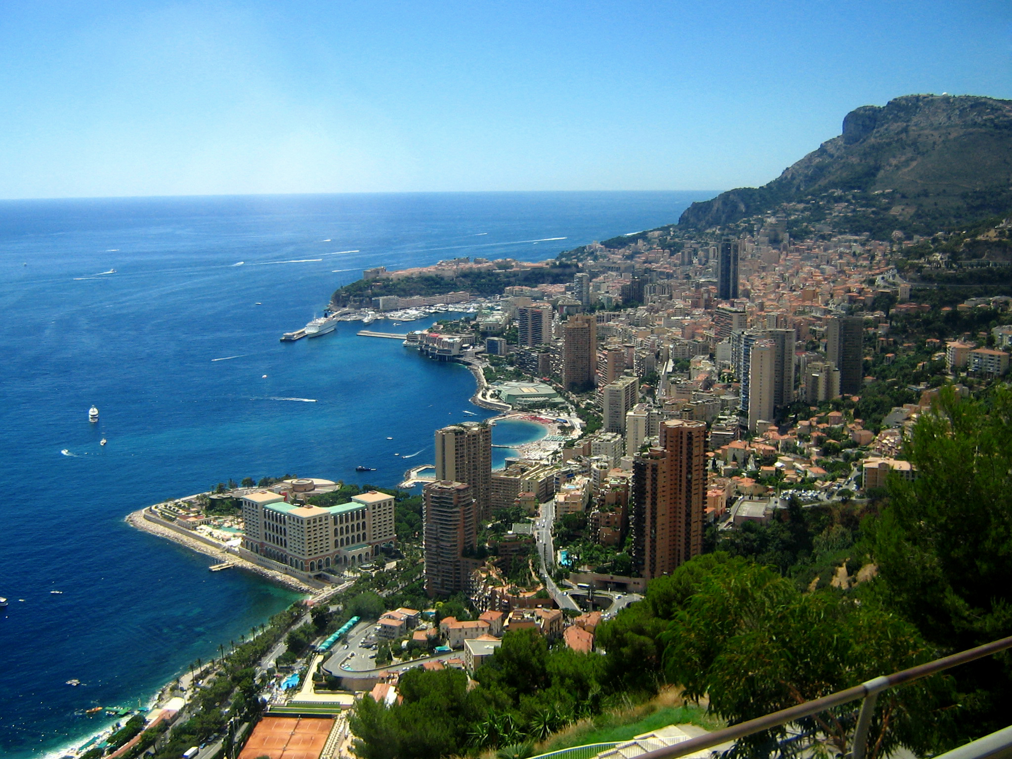
City Profile 012: Monte Carlo

CITY PROFILE 012: MONTE CARLO

Coordinates: 43°44′23″N 7°25′38″E
Elevation: Near sea level
Daily Mean Temp: 59.5 Fahrenheit (15.3 Celsius)
Metro Population: 15,200
Estimated 2050 Metro Population: Similar (due to lack of room to expand) 
Risks: Earthquakes.
Advantages: Cool weather, beautiful, wealthy, not under great threat of invasion.
Resources: Immediate: Port. Regional: Tourism, world power centre, finance, casinos, sport.
Other: This is a world power centre. Monte Carlo is a place where the world elite feel at home and among their own.

File:Whole Monaco.jpg
Photo: Hampus Cullin, 4 August 2006

Wednesday, July 13, 2011

Mr. Geography

Mohammad Saaed Collins is a Toronto cab driver also known as 'Mr. Geography'. Several years ago I happened to see him on Conan O'Brien Show (which I rarely watch). You can ask him just about anything reasonable about geography and he will know the answer. Here is a link to a facebook page dedicated to him:

http://www.facebook.com/group.php?gid=26924763993

Tuesday, July 12, 2011

Follow and message me on Twitter

I would really like to interact with some other Geography fanatics on twitter. Talk to me at Twitter.com/CalebGolston. If you want to follow me, be sure and mention to me that you are doing so for geography as I also use the twitter for my music production friends.

Hope to start some conversations soon!

Caleb

http://twitter.com/calebgolston

Friday, July 8, 2011

Denmark

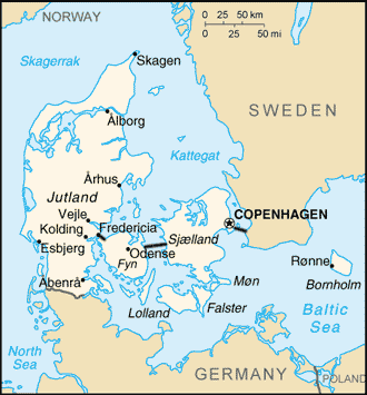
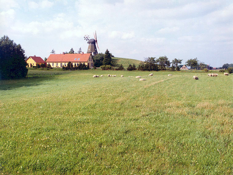
Denmark is not a country many people think is very exciting. I am very interested in Scandanavian though, its history, geography, archaeology and culture. Denmark has a milder climate than Norway or Sweden and also has flatter land. The capital is Copenhagen and there are 5.5 million people in Denmark. The countryside is low stress with lots of farms.

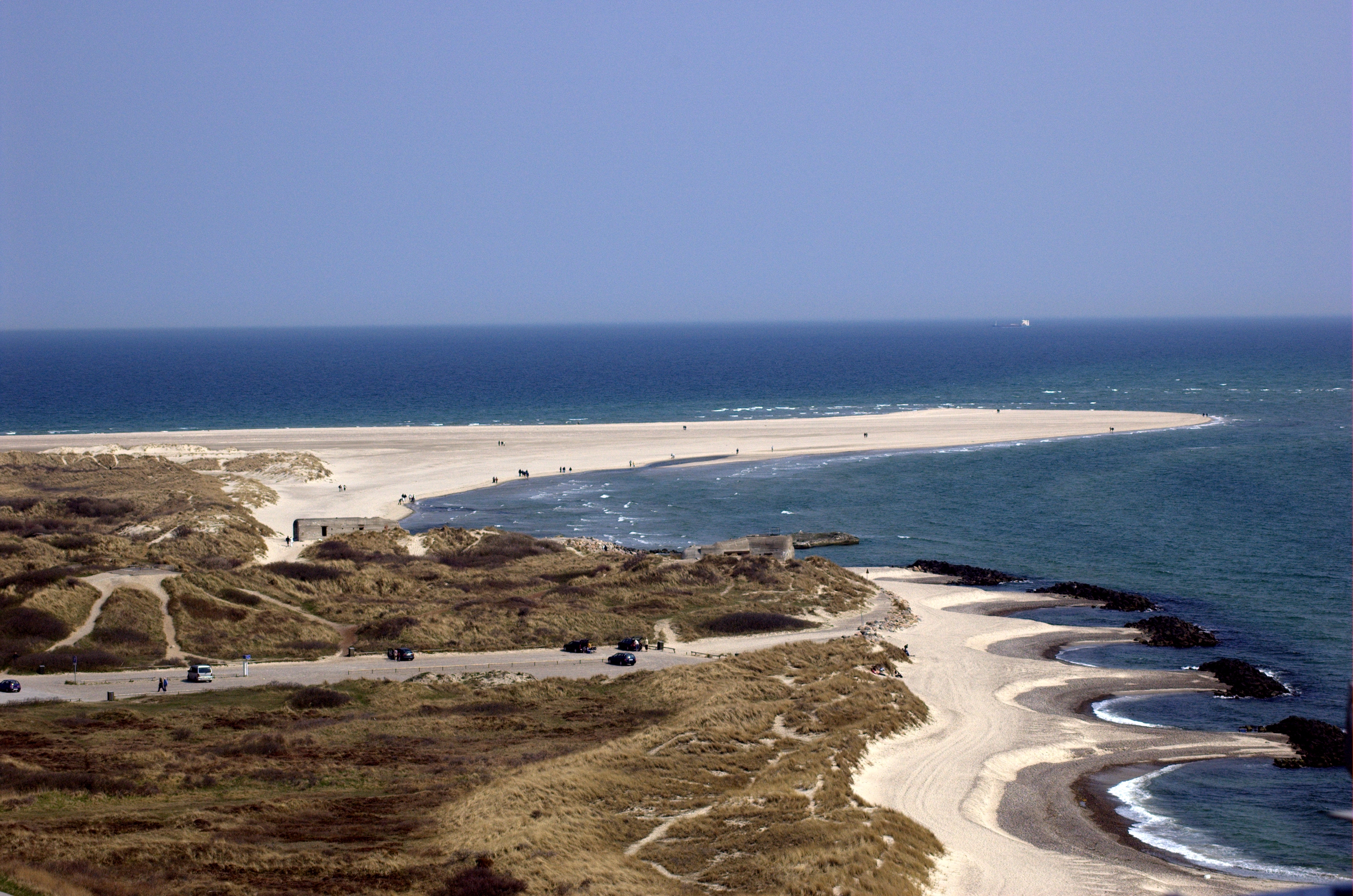
One of the great features of Denmark is its western coastline. Unlike many coastlines which do not face the ocean directly (due to other landmasses breaking the waves, bays, sounds, ect) it features large waves coming in and out like the famous coasts of California or Australia. Denmark is a peaceful country with a high standard of living. While its landscape doesn't feature canyons, mountains, deserts, cliffs or other extreme features, it is green and calm. The ocean meets the Jutland Peninsula and quitely land becomes sea. A few large islands in Eastern Denmark are highly populous as well.
File:Da-map.png

File:Vor Frelsers Kirke-view10.jpg
Copenhagen

File:Skagen aka the skaw northmost point of denmark 6th may 2006.jpg

File:Oeresund Bridge.jpg
Øresund Bridge

File:KarleboL.jpg
Karlebo, Sjælland, Denmark 2005. Photo: JM Rice.

File:Sandy cliff beach at North Sea, Denmark 2004 ubt.jpeg
Sandy cliff beach at the North Sea, Vendsyssel, Denmark, 2004. Photo: Tomasz Sienicki

File:Rebild National Park 02 ies.jpg
Rebild National Park in Denmark. Photo: Frank Vincentz

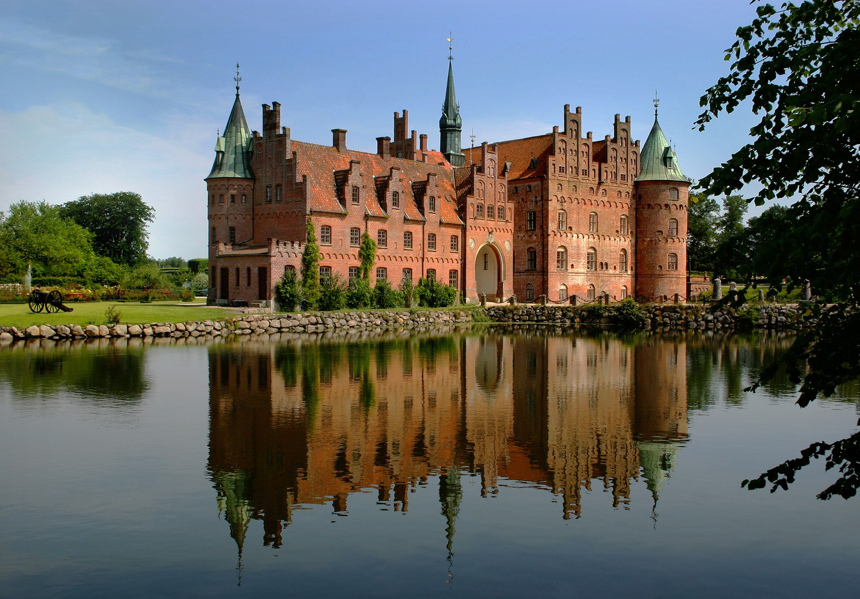
File:Egeskov Slot spejling Edit 2.jpg
Egeskov Castle Photo: Malene Thyssen


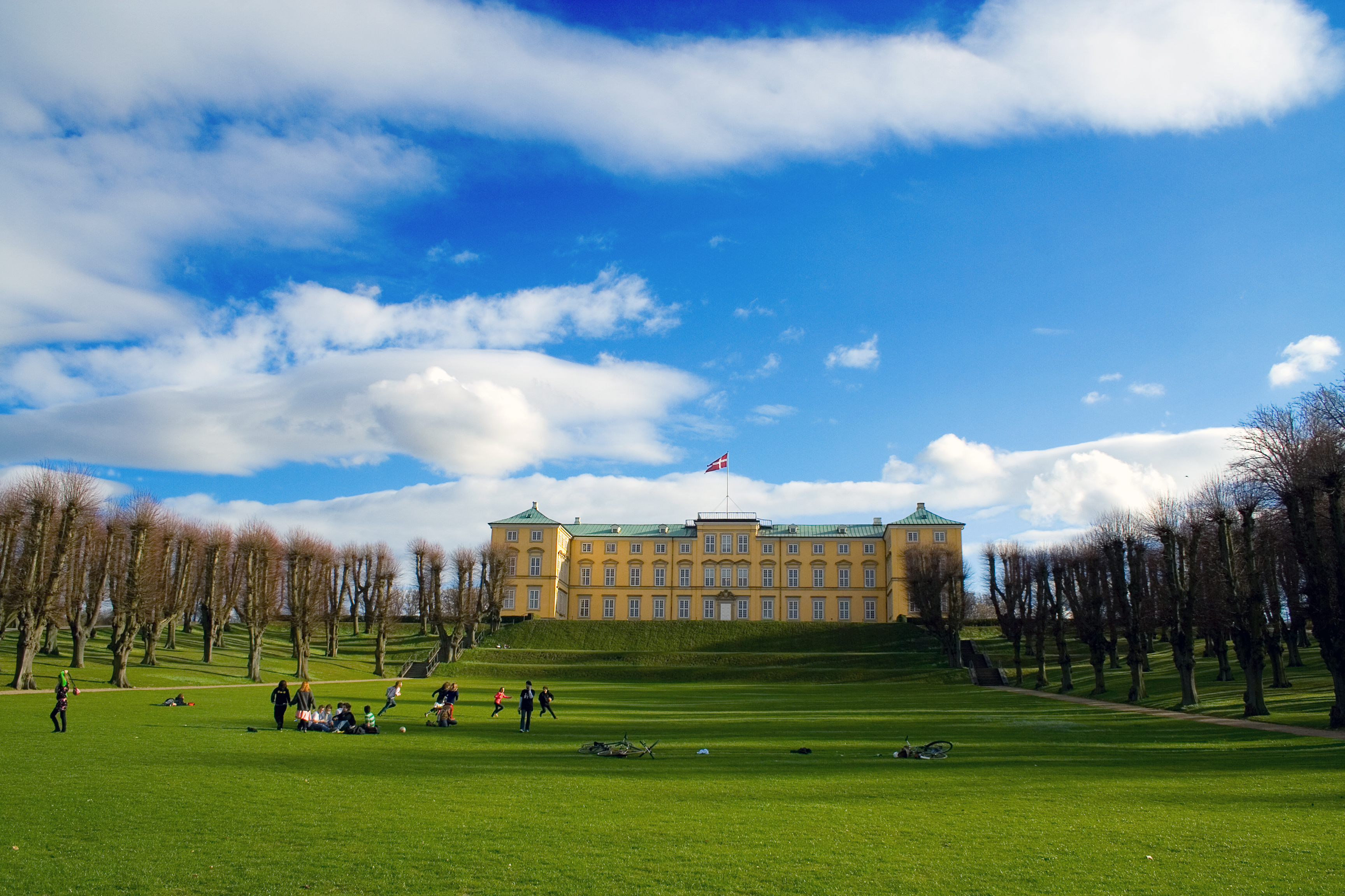
File:Frederiksberg Have 2006.jpg
Frederiksberg Have, 2006 Photo: Jacob Bøtter


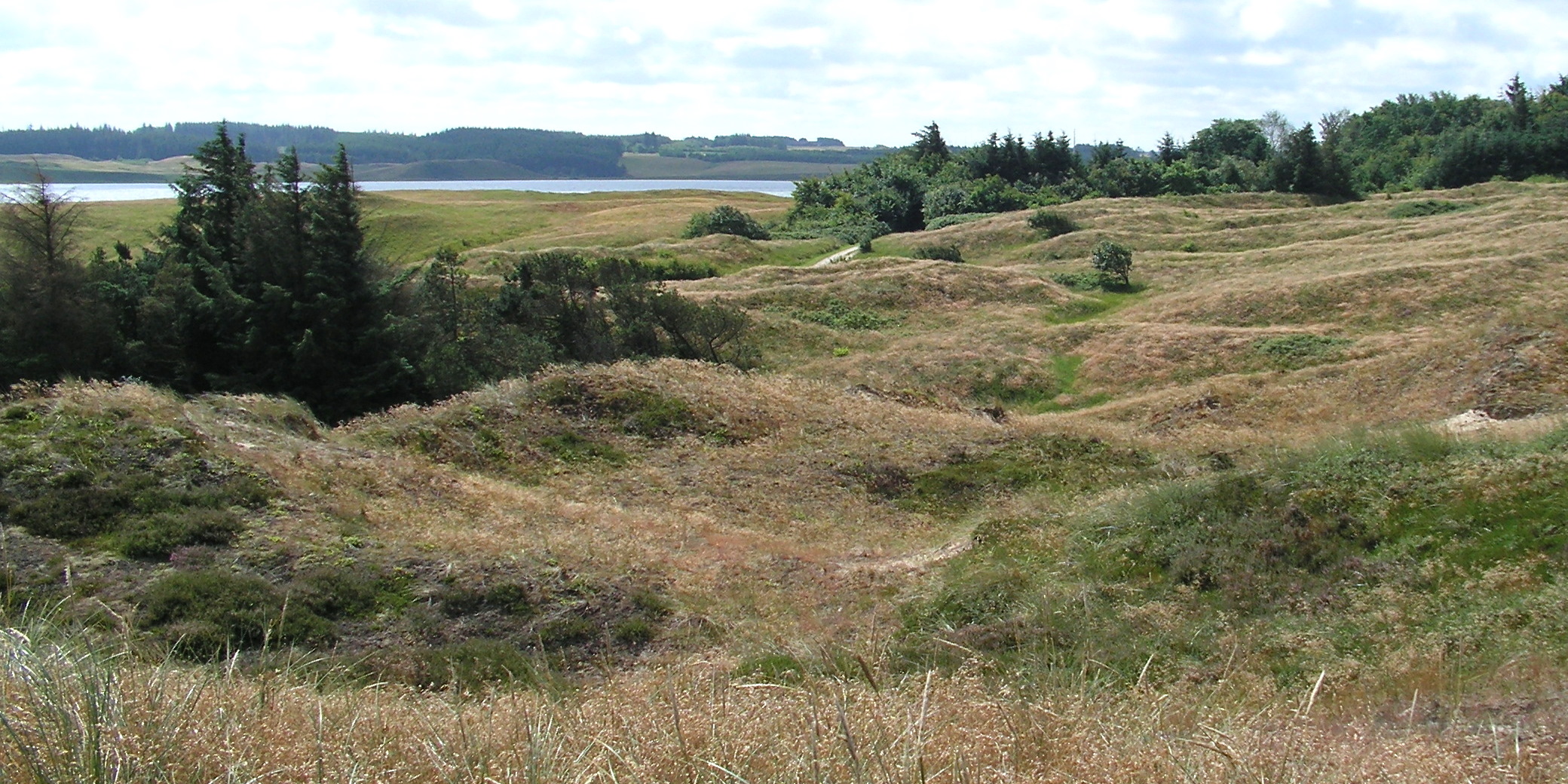
Fil:Tved Klitplantage.JPG
Thy Nationalpark, Denmark. Photo: Jens Buurgaard Nielsen

Fil:Thy Nationalpark.JPG
View over part of the Thy Nationalpark (Denmark) at Hanstholm vildtreservat and Tved klitplantage, 2007. Photo: Jens Nielsen.


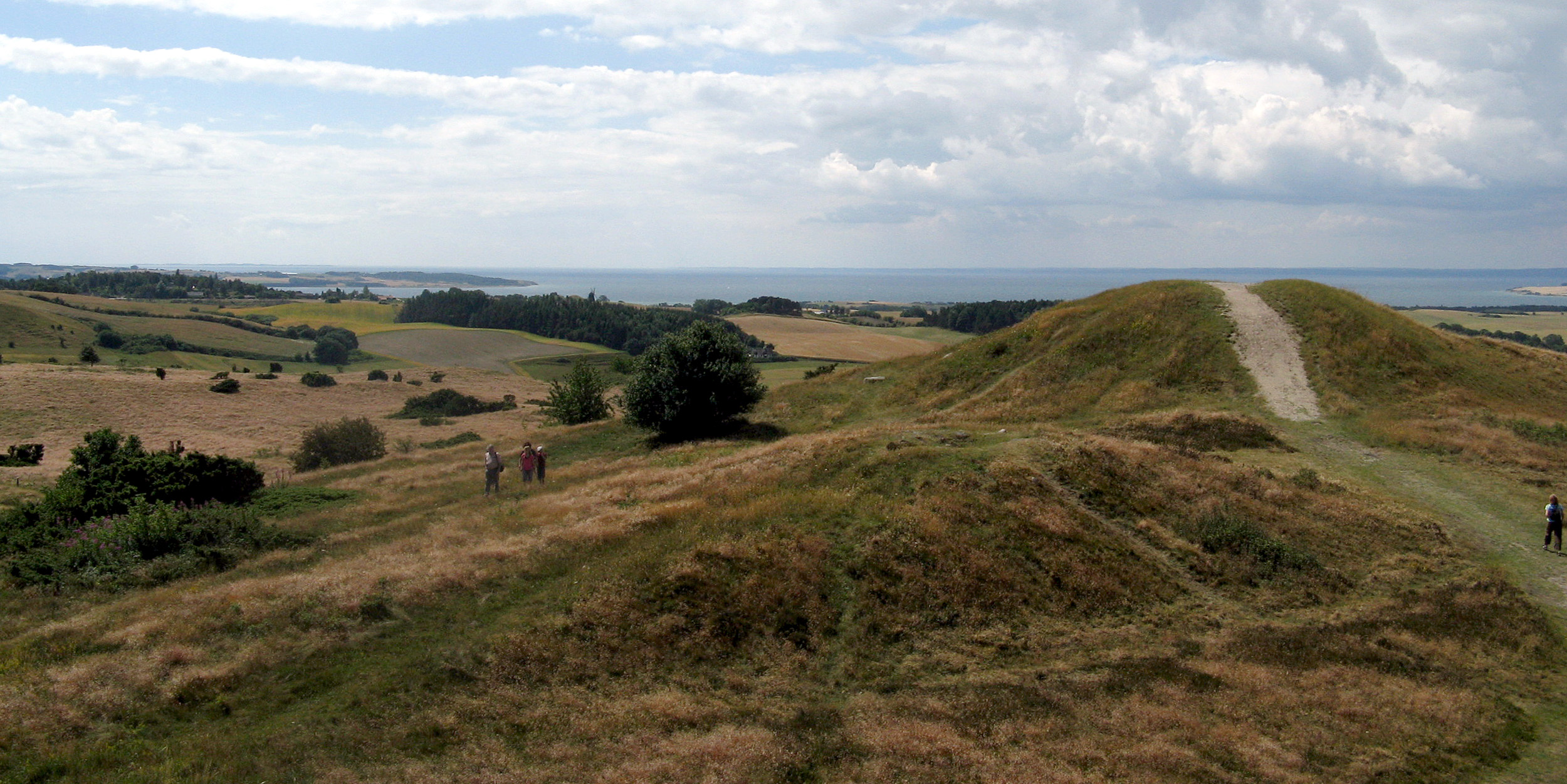
Fil:Trehoje i Mols Bjerge.jpg
Nationalpark Mols Bjerge Photo: Nico

Thursday, July 7, 2011

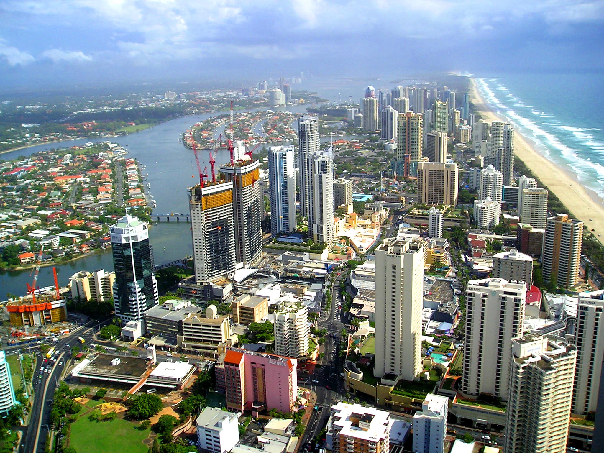
City Profile 011: Gold Coast, Queensland, Australia

CITY PROFILE 011: GOLD COAST, QUEENSLAND, AUSTRALIA

Coordinates: 28°00′22″S 153°25′46″E

Elevation: Sea level
Daily Mean Temp: 70.1 Fahrenheit (21.15 Celsius)
Metro Population: 591,473
Estimated 2026 Metro Population: 730,000
Risks: Floods, hot weather.
Advantages: Coastal, scenery, wealthy city, historically safe region of the world, located in one of the wealthiest countries.
Resources: Immediate: Port. Regional: coal, gold, sand, magnesium, bauxite, aluminium, lead, silver, zinc.
Other: Regional film capital, tourist destination.


File:View-from-Q1-looking-north.jpg

Wednesday, July 6, 2011

McDonald Observatory

Recently, my dad told me about a co-worker of his who was retiring to West Texas in a special community for sky watchers. The surrounding Chihuahuan desert isn't a bad setting either for those interested in desert landscapes. He had sent a link to some pictures of the area and I was somewhat surprised by how drawn I was to the idea. It looked ideal. I have been to the Chihuahuan Desert a few times, once in the Villa Ahumada, Mexico area. It was the most deserted and quite place I have ever been too. On either side of the highway was miles and miles of untouched (virtually obviously) land.

Though the wealthy and modern, yet isolated and wild community was located in a nice setting, the real reason it was in the desert was because of this:

File:Earthlights dmsp.jpg

The above map is a map of the earth at night (obviously it is a collection of images taken at different times since it isn't night everywhere at the same time). The map highlights light pollution of major cities. In fact, it is amazing how clearly you can major cities represented as dots of light similar to dots on a map. Look, you can see Dallas really well, Houston well, Tokyo, Perth, Durban barely, Stockholm, Oslo, Anchorage, I can even see Fairbanks easily.

Now, located near my fathers-coworkers west Texas community, in the same desert, is the McDonald Observatory.

File:HET Dome.jpg
Hobby-Eberly Telescope. It houses one of the largest optical telescopes in the world.

File:107-inch at dusk.JPG
Harlan J. Smith Telescope preparing for observations.

The Observatory has 4 telescopes, the largest, Hobby-Eberly Telescope and the much smaller Harlan J. Smith Telescope, Otto Struve Telescope and a large format imaging telescope. The observatory opened in 1939 with the building of the Otto Struve Telescope, at the time had the second largest telescope in the world. Eventually control went to The University of Texas. Today, visitors come and see the telescopes which to this day scan the stars.

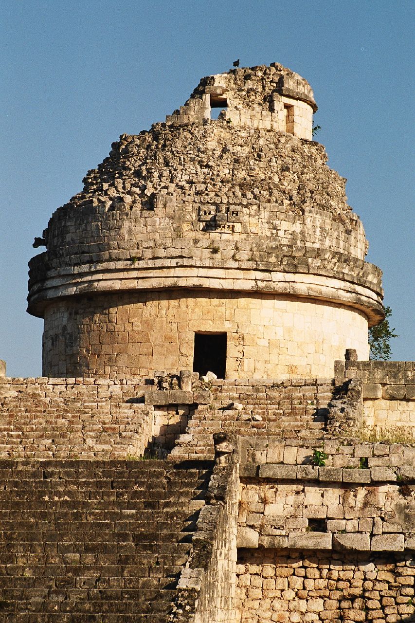
I can't help but think about the ancient people who also scanned the stars and that connection we have to our ancestors (whether it be Mayan, Babylonian, Chinese or Viking, ect). The Maya located far but in the same larger region as West Texas built observatories too:

File:Chichén Itzá Mayan observatory.jpg
Chichén Itzá Mayan observatory built about 900 AD (1000 years prior to the McDonald Observatory), 2005. Photo: Bruno Girin

We will always be interested in the universe and in the stars within it. West Texas is a great place to do it, as is anywhere on earth, so long as we turn the lights out sometimes to be able to see.

File:McDonald Observatory.jpg
 A view of McDonald Observatory from highway TX-118, 2008. Photo: Jason Quinn.

File:Big Bend Ocotillo 2006.jpg
Ocotillo and other Chihuahuan Desert plants with the Chisos Mountains in background, Big Bend, Texas 2006. Photo: Leaflet

Tuesday, July 5, 2011

Russia

After a week off from posting (call it a holiday) I am filing this one on Russia!

The topic of Russia is vast. The history, archaeology and geography each could be a blog. Russia is easily the largest country in the world by land area. It is the 9th largest in population behind Nigeria and ahead of Japan. Much of the land is harsh--but it is beautiful. The capital and largest city is Moscow (Москва). Saint Petersburg (Санкт-Петербург) Novosibirsk (Новосибирск), Yekaterinburg (Екатеринбург) and Nizhny Novgorod (Нижний Новгород) round out the top 5 cities in Russia.Within Russia is 1/4th of the worlds fresh water, 100,000 rivers and the worlds largest timber reserves. Also, Russia has the second most total renewable water resources after Brasil.

Russia is a powerhouse in intellectual fields such as mathematics, science and strategy games (like chess). Russians are also a growing power in the music production field (which I am involved in). Some notable people from these fields include Grigori Perelman, Yakov Eliashberg, Nikolai Efimov, Albert Shiryaev and Garry Kasparov.

At different points in history, Russia has been considered a 'super-power'. Now, few would say it is. However, this could (and I think will) change soon. If the West continues its mindless direction, the future is Asia's and Russia is included in this. Russia is rich in oil and natural gas, a sure sign of strength. Rail transportation in Russia is dominated by Russian Railways, a monopoly which employs 950,000 people. The economy continues to improve for Russians.

Russia's physical geography is immense. Within Russia are many mountain ranges, lakes, rivers, deserts and tundra, taiga and almost every type of landscape. The land can be bleak but this makes it interesting. Cities are found all across Russia. From the northern most natural border with the artic to the eastern most natural border with the vast bering sea. Many parts of Russia get as cold as anywhere on the planet. The continental climate of much of Siberia means it also can get hot, sometimes, 99 degrees. I am definatly going to write more on Russia in the future.
File:Осетр река.jpg
Osyotr river (Осётр река) 


File:Kazan church edit1.jpg
All Religions Temple. A building and cultural center build by the local artist Ildar Xanov. Photo and description: Maarten


File:PeterhofGrandCascade.JPG
Peterhof, St. Petersburg

File:Serpeevka village.JPG
Outskirts of Serpeevka village. Cleyabinsk region, Russia. Окрестности деревни Серпеевка. Челябинская область, Россия. Photo: Скампецкий


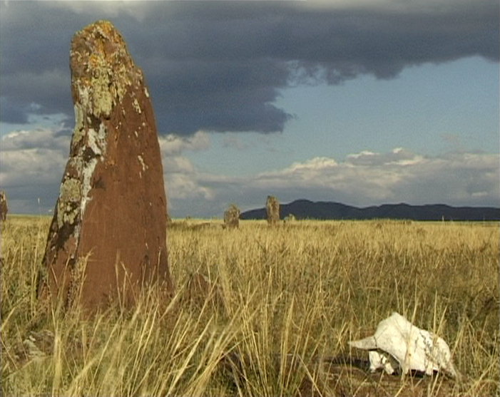
File:Abakan16.jpg
Megalith near village Kazanovka in Republic Khakassia, Russian Federation. Photo by Anatoly Terentiev, 13 September 2000.
File:Abakan24.jpeg
Khakassia view. Photo by Philipp Poddubitsky, 14 October 2000.

File:Abakan09.jpg
Megalith near village Safronov in Republic Khakasiya, Russian Federation. Photo by Anatoly Terentiev, 13 September 2000.

File:Кезеной Ам (Kezenoy Am).jpeg
Kezenoy Am (Кезеной Ам), 29 July 2009. Photo: Agidel


  File:Petropavlovsk Kamchatsky at night.jpg
Petropavlovsk Kamchatsky at night.
 
File:Amga.jpg
Amga
 
File:Altai Kutscherla-See.jpg
Altai, Lake Kutsherla in Altay Mountains, Russia 2001. Photo: Stefan Kühn.


File:BaikalForest (pixinn.net).jpg
Taiga Forest near Lake Baikal, Russia, 2008. Photo: Christophe Meneboeuf.


 File:Ignateva cave entry.jpg
Ignateva cave entry 2009 (Вход в Игнатьевскую пещеру) Photo: Sultan Brukhanov.

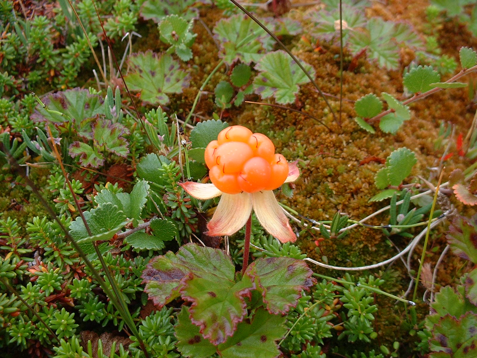
File:Hjortron.jpg
Ripe Cloudberry (Rubus chamaemorus), February 2006 common to the Urals. Photo: Philipum.


File:Ob river.jpg
Ob River (Река Обь) Photo: Игоревич

File:Uvs núr.JPG

Lake Uvs (Убса) Photo: Jan Sysel.

^^Look how desolate the above picure is! Just earth and water, nothing else. It is stark, vast and a contradiction of inviting and uninviting. On the one hand, I would like to be there and see this place, on the other hand, I wouldn't want to be there forever.

File:Yakutsk 1 (synchroswimr).jpg
Yakutsk, 2007. Photo: "synchroswimr"/Stacy

*Caleb's Sidenote: Doesn't this picture look like it could have been taken in the 60's, 70's or 80's (it is dated 2007) ? I think Russia is fasinating, but it seems VERY depressing in some parts.

File:Lone-maiden-formation.jpg
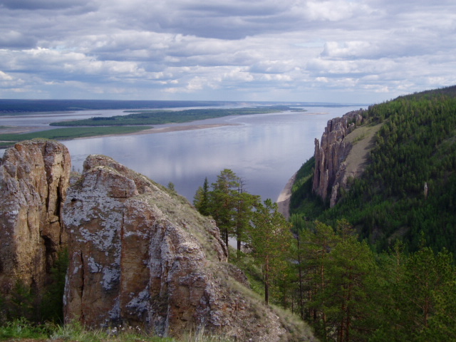
Lone Maiden Formation, Lena River.

File:Ferroviacircolarebaikal.jpg
Circum-Baikal Railway, southwestern tip of Lake Baikal.

File:Buchta Nagajewa (Magadan).jpeg
Nagayevo Bay near Magadan, Russia (Бухта Нагаева, вид с Магадана) 2006. Photo: Obersachse


File:Forest tundra.jpeg
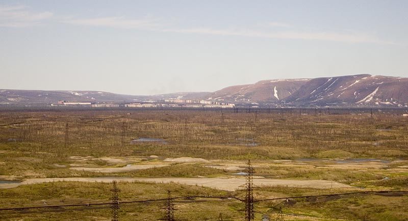
Forest-tundra landscape example (Norilsk, Russia environment) Образец заповедной  (2006-06-26) Photo: Grain

File:Brat i sestra nakhodka.jpg

The cliffs Brat ("Brother") and Sestra ("Sister") in the environs of Nakhodka, 2006. Photo: adfoto