Tuesday, August 20, 2013

Uganda

Uganda is a country of nearly 36 million people. It is landlocked and the equator passes through it. The country mostly lies on the East African plateau with mountains in some parts. The tallest mountain in Uganda is Mount Stanley (it is also in The Democratic Republic of the Congo). Mount Stanley is a part of the Rwenzori Mountains and has an elevation of 16,762 feet. Part or all of several lakes are in Uganda including, Lake Victoria, Lake Albert, Lake Kwania, Lake Kyoga, Lake George and Lake Edward.

The capital and largest city of Uganda is Kampala, with nearly 1.7 million people. The second largest city in Uganda is Gulu with nearly 147,000 people. The official languages of Uganda are Swahili and English. Uganda is divided into 4 administrative regions and over 100 districts.    

File:UgandaOMC.png
Map of Uganda. Map Credit: Kelisi.


File:Uganda-Development.JPG
Downtown Kampala. Photo Credit: Andrew Regan.

File:Suburban Kampala.jpg
Suburban Kampala, Fall 2006. Photo Credit: Michael Shade. 

File:Kabale landscape.jpg
Kabale Landscape, Uganda. Photo Credit: Edirisa.

File:Ruwenpflanzen.jpg
"Plants in the Ruwenzori Mountains, SW Uganda, Bujuku Valley, in about 3700 m altitude. Center back, hung with lichen, a high tree Erica way forward both hands "trees" with bright green leaves (Dendrosenecio adnivalis) and Lobelia and in front of straw flowers." Photo and Description Credit: Manuel Werner. 

File:Kaabong landscape.jpg
Kaabong District, Uganda. Photo Credit: Keitsist.

Saturday, August 17, 2013

The Democratic Republic of the Congo

The Democratic Republic of the Congo (also known as the DRC) is the 11th largest country in the world by area. It is the 19th largest country in the world by population with over 75 million inhabitants. The DRC is home to one of the worlds most important tropical rainforest ecosystems: the Congo rainforest.  It is the the worlds second largest tropical forest in the world, after the Amazon. The heart of this rainforest is the Congo river, which is the the worlds 9th longest river and the deepest river in the world. It is as deep as 720 feet in some places.

Within the DRC is Mount Nyiragongo, an active stratovolcano, which is in the Virunga Mountains. It rises to an elevation of 11,385 feet. Another volcano in the DRC and in the same mountain range is Nyamuragira, also active and rising to 10,033 feet.

The capital and largest city in the Democratic Republic of the Congo is Kinshasa, with over 9 million people. The official language of the DRC is French. In fact, the Democratic Republic of Congo is actually the largest country by population with an official language of French, with France being second.

File:River Congo.svg
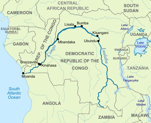
Map of the River Congo, showing national boundaries. Map and Description Credit: Hel-hama


File:La rivière Lulilaka, parc national de Salonga, 2005.jpg
Salonga National Park, in the Congo River basin rainforest, 2005. Photo Credit: Radio Okapi
 
File:Kinshasa 2003.jpg
Kinshasa, Democratic Republic of the Congo. Photo Credit: Vberger, 2003.

File:Katanga Hills.jpg
Katanga Hills, October, 2011. Photo Credit: sebastienlavoie

File:Nyiragongo2004.jpg
Nyiragongo Volcano in Democratic Republic of the Congo. Photo Credit: Maik Bunschkowski, 2004.

File:LukenieRiver.jpg
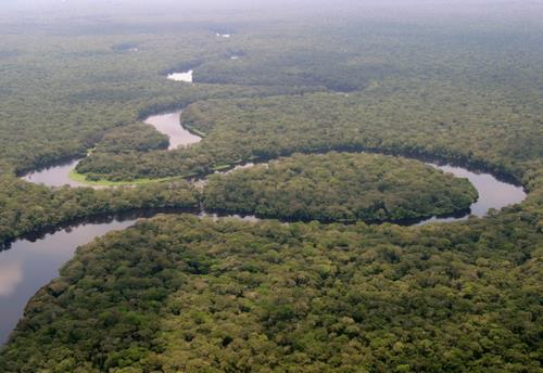
Aerial view of the Lukenie River of central Democratic Republic of the Congo (DRC) in 2007. Photo & Description Credit: Valerius Tygart.