Minnesota has a diverse geography of at least four regions: Eastern Broadleaf Forest, Plains, Laurentian Mixed Forest and Tallgrass Aspen Parkland. Approximately a third of the state is forested. The Mississippi river originates in Minnesota and Minneapolis is built along it. The capital and second largest city of Minnesota is St. Paul. The largest city is Minneapolis, the third largest is Rochester and the fourth largest is Duluth. The Minneapolis-St. Paul Metro area has about 3.3 million people and is the 16th largest metro area in the United States. Minnesota is often known a state with an abundance of water. In addition to more than 11,000 lakes, there are over 6,500 rivers and streams in Minnesota. The state experiences a wide array of temperatures, from a record low of -60 degrees Fahrenheit (-51 Celsius) to a record high of 114 degrees Fahrenheit (46 Celsius).
Skyline of St. Paul, Minnesota. Photo by: AlexiusHoratius
Blue Mounds State Park, Minnesota. Photo by: Kirs10
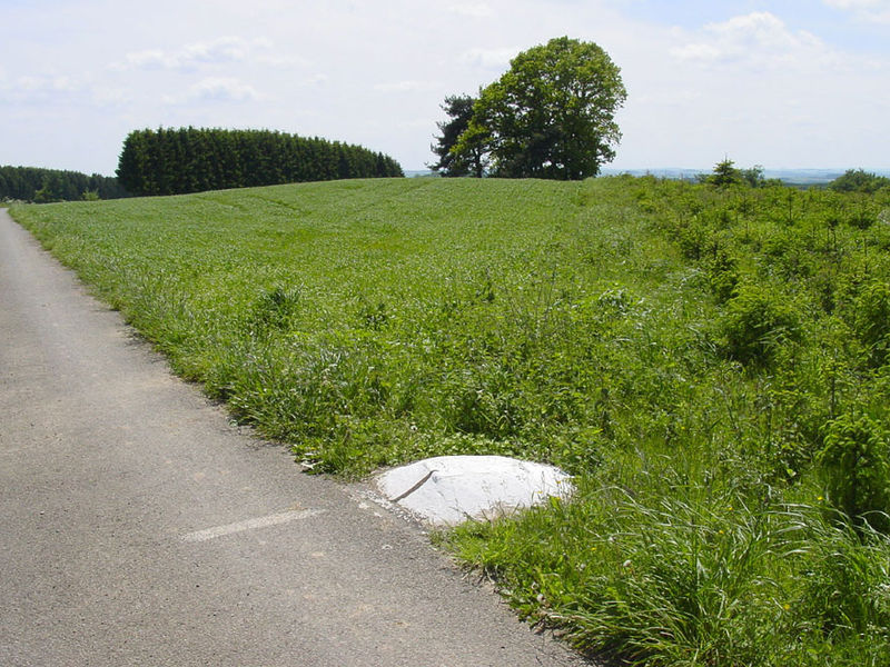
View from near the top of the highest point in Minnesota, Eagle Mountain. Photo: Douglas Kaye, 2006.
Summit of Lima Mountain, Cook County Minnesota. Photo: Pete Nekola.
Bear Head Lake, Minnesota. Photo: McGhiever
Wednesday, May 29, 2013
Monday, May 27, 2013
Luxembourg
Luxembourg is one of the smallest countries in the world, in area and population. It is a landlocked country in Europe and is bordered by France, Belgium and Germany. There are three official languages of Luxembourg; French, German and Luxembourgish. The Luxembourgish language is spoken by about 400,000 people in the world and has borrowed many French words. When Luxembourg is grouped with The Netherlands and Belgium it is sometimes referred to as being a part of 'Benelux'. The name 'Benelux' is formed with the first few letters of each country: Be= Belgium ne= Netherlands lux= Luxembourg. Luxembourg City is the largest city in Luxembourg with almost 104,000 people and is also the capital of the country. With nearly 30,000 people, Esch-sur-Alzette (Which is French, it is known as Esch-an-der-Alzette in German), is the second largest city in Luxembourg.
Kneiff, the highest point in Luxembourg at 1,837 feet (560 meters). Photo by David Edgar.
Picture from Esch-sur-Alzette, the second largest city in Luxembourg.
Map of Luxembourg
Kneiff, the highest point in Luxembourg at 1,837 feet (560 meters). Photo by David Edgar.
Picture from Esch-sur-Alzette, the second largest city in Luxembourg.
Map of Luxembourg
Thursday, May 23, 2013
What Is An Archipelago?
No, an archipelago is not a music theory term; it is a geographic term for a group or chain of islands in close proximity to each other.
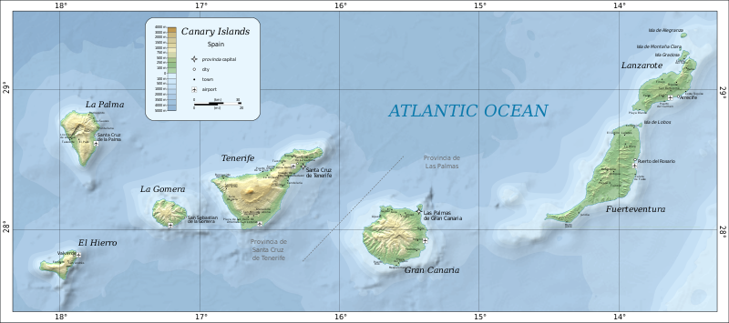
Some of the most well known examples include Indonesia and the Philippines, while well known countries that many might not realize are archipelago's include Japan, New Zealand and the United Kingdom. There are many archipelagos in the world, including Vanuatu, Solomon Islands, South Orkney Islands, Ă…land Islands, Canary Islands, Seychelles Islands, Florida Keys, Aleutian Islands, Balearic Islands and many more. Some, like the Ryukyu Islands, are a part of larger archipelagos; the Ryukyu islands being a part of Japan. Even freshwater lakes can have archipelago's, Lake Erie has the uncreative yet effectively named Lake Erie Islands. Here are the maps of two archipelagos:
Map of the Canary Islands. Map credit: Wikipedia user: Mysid
1916 map of the Western Aleutian Islands in what was then the Alaska Territory.
Subscribe to:
Posts (Atom)